HOME RANKINGS CHALLENGES ROUTES POI PLANNING SEARCH LOGIN
Italy - Trentino-Alto Adige/Südtirol, BZ
2024/07/25 17:48:15

Forcella Grubl (Grüblscharte) da Dobbiaco

33 Downloads
3
 
Share
Author
nonnocarb
(284)
Place
Italy - Trentino-Alto Adige/Südtirol, BZ
Km
56,06 km
Elapsed time
04:53:50
Vertical meters
+1 900 mt (1036 - 2391)
Route difficulty
Landscapes
Last update
2024/07/25 18:30:07
Comments
0
Description

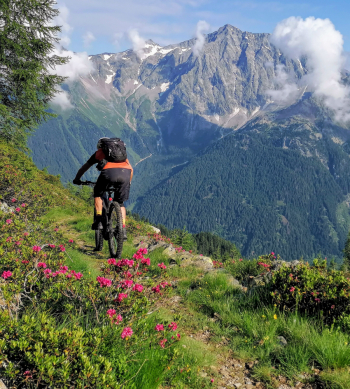
The Grübl Fork, (Grüblscharte), is a spectacular pass at 2,400 meters that connects the Casies Valley with the Antholz Valley.

Although the valley to get there is steep and wild, the two main valleys are excellently connected by an old military trail, still perfectly maintained.

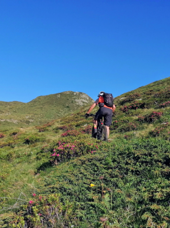
I had already done this route a few years ago by mtb, and in the comments I had written: with the regular bike there are about 250 meters of elevation gain by pushing, while I think by ebike you can pedal all the way to the top.

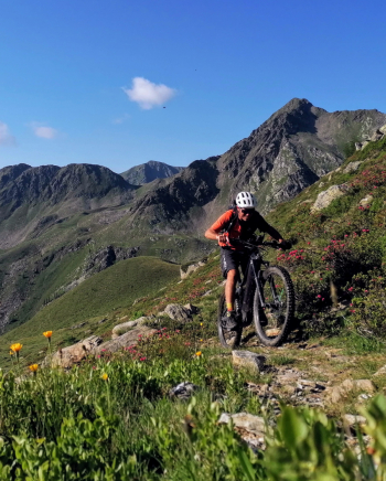
And indeed it is, with good technique in e-bike you can pedal all the way to the fork. As soon as we reach the top, here is the surprise, beautiful! Suddenly the spectacular Vedrette di Ries appear right in front.

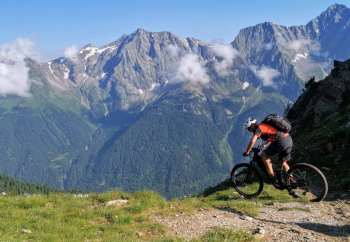
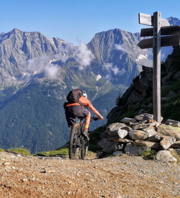
The descent then is just as beautiful, still on a military trail, with about 150 comfortable hairpin bends, you descend 1200 meters to Anterselva. Tough, wild and spectacular tour, starting from Toblach it is about 60 km and 1900+.

Download our free mobile app to send this route to your Garmin device or to navigate it on OSM maps. Android - iOS
Local weather
Stasera
11 °C
Domani
22 °C
Domani sera
13 °C
lunedì
16 °C
Lunedì notte
8 °C
martedì
18 °C
Martedì notte
8 °C
mercoledì
17 °C
Mercoledì notte
9 °C
giovedì
11 °C

Graph

Nearest Routes

2023/02/26
- Italy - Trentino-Alto Adige/Südtirol, BZ
nonnocarb
(284)
35,05 km
Km
+505 mt
Vertical meters
Route difficulty
Landscapes
2023/03/04
- Italy - Trentino-Alto Adige/Südtirol, BZ
nonnocarb
(284)
37,05 km
Km
+1 550 mt
Vertical meters
Route difficulty
Landscapes
2023/03/01
- Italy - Trentino-Alto Adige/Südtirol, BZ
nonnocarb
(284)
76,61 km
Km
+2 400 mt
Vertical meters
Route difficulty
Landscapes
2023/03/04
- Italy - Trentino-Alto Adige/Südtirol, BZ
nonnocarb
(284)
71,87 km
Km
+1 820 mt
Vertical meters
Route difficulty
Landscapes
2023/02/26
- Italy - Trentino-Alto Adige/Südtirol, BZ
nonnocarb
(284)
28,41 km
Km
+510 mt
Vertical meters
Route difficulty
Landscapes
2023/03/06
- Italy - Trentino-Alto Adige/Südtirol, BZ
nonnocarb
(284)
30,64 km
Km
+890 mt
Vertical meters
Route difficulty
Landscapes
2022/10/22
- Italy - Trentino-Alto Adige/Südtirol, BZ
nonnocarb
(284)
20,17 km
Km
+1 136 mt
Vertical meters
Route difficulty
Landscapes
2023/02/26
- Italy - Trentino-Alto Adige/Südtirol, BZ
nonnocarb
(284)
22,60 km
Km
+1 100 mt
Vertical meters
Route difficulty
Landscapes
2023/03/04
- Italy - Trentino-Alto Adige/Südtirol, BZ
nonnocarb
(284)
55,01 km
Km
+1 450 mt
Vertical meters
Route difficulty
Landscapes
2023/03/05
- Italy - Trentino-Alto Adige/Südtirol, BZ
nonnocarb
(284)
28,95 km
Km
+1 110 mt
Vertical meters
Route difficulty
Landscapes

0 Comments