HOME RANKINGS CHALLENGES ROUTES POI PLANNING SEARCH LOGIN
Switzerland
2024/06/22 20:30:44

Brüsacü Bike

6 Downloads
0
 
Share
Author
marco
(129)
Place
Switzerland
Km
21,87 km
Elapsed time
02:48:52
Vertical meters
+1 297 mt (556 - 1797)
Route difficulty
Landscapes
Last update
2024/06/22 20:32:04
Comments
0
Description

Nara ski area route with a long and varied descent. Starts at the Nara chairlift, with ample free parking. I put the start in the middle of the climb to break it into two, as it is quite long. Also, those who want to, on weekends, can save 550 meters of elevation gain by taking the chairlift. The climb is up to the top station of the chairlift itself on a nice paved road with fantastic views of the Blenio Valley.
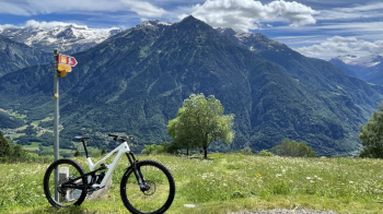
It continues a bit more on asphalt, with a steeper section, and then on a nice dirt road with a section carved into the rock.
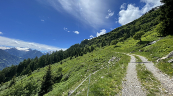
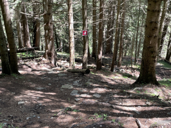
The great thing about this route is that it is almost completely tabbed with red trail marker 384, so it is very easy to follow. When you reach the highest point of the tour, at an elevation of 1800, the road begins to descend gently to an alpine hut, where the descent trail begins. You cross a pasture, after which 1300 meters of mostly singletrack descent into the forest begins, with some transfer sections on paved roads. The surface ranges from roots to boulders to prepared banks in the final part. It is never really difficult except for 3 very narrow serpentines that are difficult to do in the saddle.
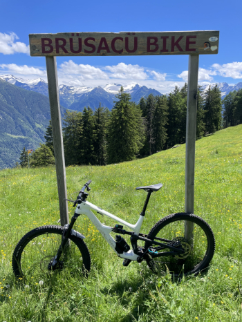
There are some sections with slow, steep turns, but all doable with decent technique and good brakes. This brings us to Acquarossa, on the valley floor, where the 400 meters of elevation gain back to the chairlift await, all on a small paved road with little traffic. There is no shortage of fountains on this ride.
Download our free mobile app to send this route to your Garmin device or to navigate it on OSM maps. Android - iOS
Local weather
Today
6 °C
Tonight
0 °C
Tomorrow
6 °C
Tomorrow night
3 °C
Tuesday
8 °C
Tuesday night
1 °C
Wednesday
8 °C
Wednesday night
0 °C
Thursday
8 °C
Thursday night
-4 °C

Graph

Nearest Routes

2024/06/22
- Switzerland
marco
(129)
9,39 km
Km
+624 mt
Vertical meters
Route difficulty
Landscapes
2024/08/25
- Switzerland
marco
(129)
73,09 km
Km
+2 560 mt
Vertical meters
Route difficulty
Landscapes
2022/10/15
- Switzerland
marco
(129)
17,35 km
Km
+843 mt
Vertical meters
Route difficulty
Landscapes
2022/10/09
- Switzerland
marco
(129)
33,95 km
Km
+1 647 mt
Vertical meters
Route difficulty
Landscapes
2024/08/22
- Switzerland
marco
(129)
39,45 km
Km
+1 721 mt
Vertical meters
Route difficulty
Landscapes
2022/10/15
- Switzerland
marco
(129)
22,11 km
Km
+580 mt
Vertical meters
Route difficulty
Landscapes
2022/10/09
- Switzerland
marco
(129)
56,35 km
Km
+1 850 mt
Vertical meters
Route difficulty
Landscapes
2022/09/17
- Switzerland
marco
(129)
20,86 km
Km
+1 186 mt
Vertical meters
Route difficulty
Landscapes
2022/08/18
- Switzerland
marco
(129)
24,42 km
Km
+588 mt
Vertical meters
Route difficulty
Landscapes
2022/12/20
- Switzerland
marco
(129)
22,99 km
Km
+1 249 mt
Vertical meters
Route difficulty
Landscapes

0 Comments