Italiano
 Deutsch
(Tratto della) Via del Sale in un giorno

As mentioned here the most beautiful section of the Via del Sale is the initial one up to the Don Barbera refuge. So why not conceive of a single-day tour by going on the outward section of the former military road starting from Chalet Le Marmotte up to Don Barbera and then returning by taking advantage of some variants mainly on singletrack? Basically, the alternative routes to the military road, excluding the central fort loop, are three:
- the first starts from the Don Barbera refuge: keeping to the right of the military road you enter a kind of rock garden with fixed stones generally surmountable in the saddle. One just has to be careful not to destroy the gear in the (few) narrower passages. A little further on one joins the military road.
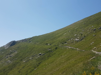
- The second takes advantage of a short section of farm track with no signs to gain in the saddle or nearly so those 70 meters of elevation gain required to go to intercept the trail coming from Scarason Pass. Shortly before arriving at the top of the hill in Italy, near the Capanna Morgantini visible in the photo but not reached by the trail, we turn left to go and tackle an aerial and exposed section of the old military road, keeping high compared to the dirt road traveled on the way up, a road that remains always visible below. WARNING, one mistake and you end up 50 or 100 meters below in the company of the cheerful groups of e-bikers engaged along the classic route. A last easy section leads to rejoining the classic route at the ruins of the Boaria barracks.
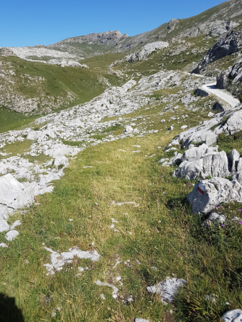
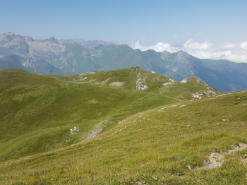
- The third begins at the Col de la Perle: with an initial section that is pedalable for those with good legs, otherwise by pushing, you circumnavigate the Cime du Bec and then go for a long singletrack mostly on a false level with some short climbs. You stay on the French side until the final descent to the central fort and then to the Col de Tende. Very beautiful and relaxing. Here some photos of the return sections to get an idea of the bottom. To be scheduled on Tuesday or Thursday, days closed to motorized traffic.
Itinerary originally posted by Lele here.