
 Italiano
 Deutsch
Punta Alta

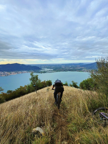
This is perhaps the best trail to be able to descend from Punta Alta. A very technical S3+ descent.
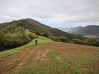
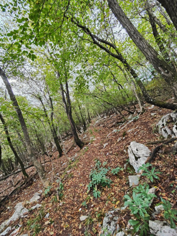
You can reach it via this track or start directly from the starting point, I don't recommend going up by MTB to the starting point directly from the lake because of the killer gradients, in EMTB it is done without problems. From the starting point to the Rolla the climb is offroad with not always comfortable bottom, very challenging but doable.
Arriving at the Rolla begins a nice smooth descent with some banks. We come out on a hill where we get a glimpse of the view of the lake,
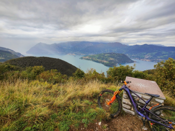
From here after a nice 50% rideable eat and drink with emtb we arrive at Punta Alta.
Here the view is a spectacle, with views of the lake and Montisola.
Now the descent alternatives are 3
- "The easy one": back the way we came (very nice and recommended to shorten the ride).
- Descent to the east (recommended to avoid long stretch of push connection): I have never done it but on the maps it is marked as S2 and to my eyes it looked well put in.
- "The uneasy": descent to the south (following the trail) S3+ descent with many S4 passages.
Obviously we descended from the most inconvenient option (the third option), the descent as I said is a nice S3+/S4 vertical with lots of high rocks, and many challenging obligatory passages. The descent is lake view but it is difficult to look up except in the moments when we stop to rest. After the junction the descent becomes less challenging.

Trail style: AM
Personal rating: 9/10
MTB: Yes (coming up from Viadanica)
EMTB: Yes
Duration about 2.5h (by emtb)
Portage: The section from Rolla to punta alta often forces you to push your bike on an almost flat trail
Difficulty ascent: Challenging
Difficulty descent: S3/S4
Exposed: NO
Drainage: Yes, but wait until the rocks are dry.


