2023/12/21 08:30:23
Altissimo da Brentonico
Author
Place
Italy - Trentino-Alto Adige/Südtirol, TN
Km
32,04 km
Elapsed time
04:52:37
Vertical meters
+1 700 mt (422 - 2061)
Route difficulty
Landscapes
Last update
2023/12/21 15:22:33
Comments
Description
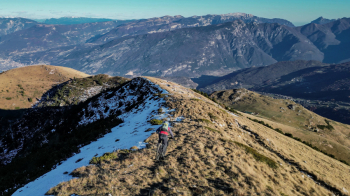
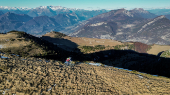
We start from the hamlet of Brentonico and climb Mount Altissimo via the Graziani refuge and finally the beautiful and scenic dirt road that will take us to the Damiano Chiesa refuge.
From here starts the equally beautiful and scenic descent that in one bang takes us back to the village of Brentonico. The descent initially on ridge and meadows does not present great difficulties while the central part has some exposed sections where you have to pay attention. Overall it can be categorized as S2 with some S3 passages.


Local weather

°C

°C

°C

°C

°C

°C
Graph
Nearest Routes
2022/10/02
- Italy - Trentino-Alto Adige/Südtirol 47,30 km
Km
+1 972 mt
Vertical meters
Route difficulty
Landscapes
2024/01/03
- Italy - Trentino-Alto Adige/Südtirol, TN 36,63 km
Km
+1 848 mt
Vertical meters
Route difficulty
Landscapes
23,53 km
Km
+1 300 mt
Vertical meters
Route difficulty
Landscapes
2023/05/19
- Italy - Trentino-Alto Adige/Südtirol, TN 37,21 km
Km
+1 900 mt
Vertical meters
Route difficulty
Landscapes
29,16 km
Km
+1 524 mt
Vertical meters
Route difficulty
Landscapes
38,03 km
Km
+1 500 mt
Vertical meters
Route difficulty
Landscapes
2023/09/03
- Italy - Trentino-Alto Adige/Südtirol, TN 35,97 km
Km
+1 700 mt
Vertical meters
Route difficulty
Landscapes
48,51 km
Km
+2 622 mt
Vertical meters
Route difficulty
Landscapes
41,35 km
Km
+1 959 mt
Vertical meters
Route difficulty
Landscapes
31,38 km
Km
+1 648 mt
Vertical meters
Route difficulty
Landscapes


 Italiano
 Deutsch