Italiano
 Deutsch
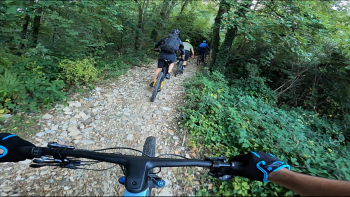
La Maddalena ed il trail n.11 Flow

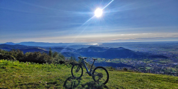
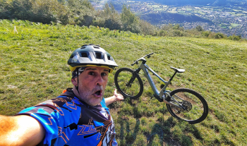
Let's discover the most flowing trail there is on Mount Magdalene, in the heart of Brescia. A fast and compelling trail that will make you fall in love with this beautiful area where you can raid all year round. Are you ready?
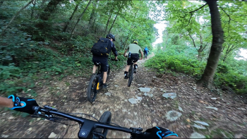
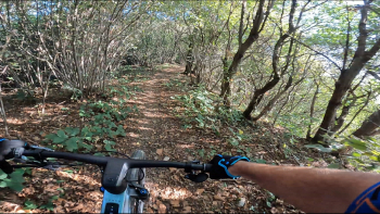
The start is in the Borgo Wuhrer area where we will take a paved road towards the city. After about 1 km we turn right and on cobblestones the climb begins. We will have to reach St. Gotthard where we will finally get out of the hustle and bustle for good, taking the Salute trail that goes into the woods and cuts the main road in a couple of places. We are on the west side of this stupendous mountain always on trail we will reach Persane Alte where we will intersect the famous Muratello that comes up from Nave. One last effort and we will reach Rifugio Monte Maddalena. From this point the games are done, at least for the climb. We move onto dirt road to Mount Denno and then up to El Golèt where a first taste of flow on the Toboga begins. We follow the trail well because due to some fallen trees the route has changed until we reach Cascina Pasotti. From here you open the throttle and let yourself be kidnapped by No. 11 that will lead you with a smile on your face to Nave: it will be a trail all to experience with few technical and extreme passages, where you just let it flow. From Nave we will now have to return to the starting point with an unavoidable relaxing transfer section, passing through the city of Brescia.
RECOMMENDED ROUTE FOR MOUNTAIN BIKE and/or E-BIKE ALL MOUNTAIN.
NB: At the time of entry this ride is all doable without any particular problems. We disclaim any responsibility for any inconvenience due to lack of maintenance of the trails or deterioration of the same due to external and/or natural agents and a wrong assessment of the tour.