Italiano
 Deutsch
Monte Ario ed il Sentiero dei Minatori F5

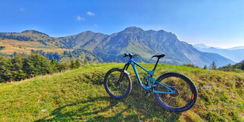
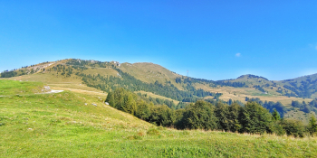
We take you to the top of Mount Ario overlooking Val Sabbia before tackling the famous Miners' Trail (F5). An incredibly beautiful area of alpine pastures where you can admire the Corna Blacca and Lake Garda from a different perspective.
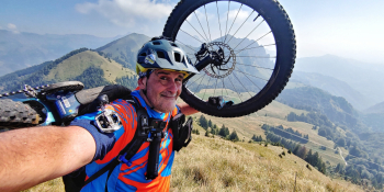
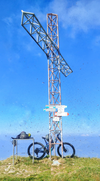
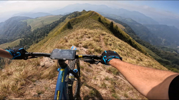
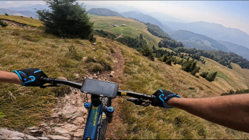
The start is from the side of Val Trompia in the hamlet of Zigole di Bovegno (BS). We cross the Mella bridge and immediately take ourselves out of the world on an uphill secondary road. The magic of this area will take us past some villages, where time seems to stand still. These are: Zigole, Magno, San Lorenzo, Irma and Carezia. We will reach the locality of Vaghezza where we will finally be able to make our first stop at the little kiosk. Here we are halfway uphill and always from this point we will leave the asphalt to switch to off-road. We start uphill again following the mule track that starts to the left of the kiosk and, after a first section of intense slope, we reach the Piazze pass. From this point short descent before going back uphill again. Now we will be enveloped by shady undergrowth until we reach Malga Pian del Bene with a 360° view. A moment of respite with a slightly downhill transfer section to Malga Campo di Nasso. Now guys let's get ready for the toughest section. Pushing and shouldering from 1,515 meters we will have to reach the 1,755 meters of the summit of Mount Ario. Let's calculate at least 30 minutes total. From the summit obviously more superlative views. Now it's downhill: first on the ridges of Ario (where be careful of some exposed points ) to the steep and bumpy section with hairpin bends to Pian del Bene. Here we turn right and on an alpine mule track we descend to Croce Pass. From this point begins the famous Trail F5 or of the Miners. An intense trail that ranges from flow, to rock n' roll, to smosso with a few hard passages but all guided and flowing. Anacondas, switchbacks and lots and lots of fun. Final stretch on very steep mule track before arriving at the mines. A downhill transfer section on asphalt and we will be at the cars.
JOURNEY RECOMMENDED FOR ALL MOUNTAIN BIKE (E-BIKE I would say no as there are about 30 minutes on the shoulder ).
NB: At the time of entry this ride is all doable with no particular problems. We disclaim any responsibility for any inconvenience due to lack of maintenance of the trails or deterioration of the trails due to external and/or natural agents and incorrect evaluation of the tour.