2022/08/05 21:04:04
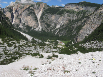
6 Rifugi - Parco Fanes-Senes-Braies
Author
Place
Italy - Veneto, BL
Km
40,45 km
Elapsed time
06:52:37
Vertical meters
+1 717 mt (1310 - 2243)
Route difficulty
Landscapes
Last update
2023/01/03 17:02:09
Comments
Description
From Pian de Loa by steep asphalt road you reach after about 3.5 km Malga Ra Stua and then in Val Salata steep trail 12 that becomes trail 13 to Rifugio Biella. Turn back and from the previous junction in a short time you reach Rifugio Sennes and still downhill Rifugio Fodara Vedla. The most beautiful part of the descent now begins, a steep single track to Rifugio Pederù. You start climbing again with the Rio San Vigilio on the left and the footpath and the Sasso delle nove e delle dieci on the right. After 500 mt. of elevation gain in the plain we find on the right of the fork the Rifugio La Varella and on the left the Rifugio Fanes and the Passo Limo. We descend to the starting point on a rough road into the Fanes Valley.

Local weather

°C

°C

°C

°C

°C

°C
Graph
Nearest Routes
30,49 km
Km
+1 550 mt
Vertical meters
Route difficulty
Landscapes
2022/09/23
- Italy - Trentino-Alto Adige/Südtirol, BZ 38,19 km
Km
+2 350 mt
Vertical meters
Route difficulty
Landscapes
34,78 km
Km
+1 493 mt
Vertical meters
Route difficulty
Landscapes
30,52 km
Km
+1 327 mt
Vertical meters
Route difficulty
Landscapes
46,01 km
Km
+2 700 mt
Vertical meters
Route difficulty
Landscapes
33,68 km
Km
+1 599 mt
Vertical meters
Route difficulty
Landscapes
29,96 km
Km
+1 832 mt
Vertical meters
Route difficulty
Landscapes
12,46 km
Km
-614 mt
Vertical meters
Route difficulty
Landscapes
48,76 km
Km
+1 500 mt
Vertical meters
Route difficulty
Landscapes
40,27 km
Km
+1 300 mt
Vertical meters
Route difficulty
Landscapes


 Italiano
 Deutsch