
 Italiano
 Deutsch
Rifugio Cassana e Passo del Leverone

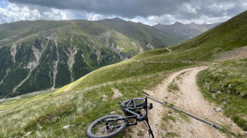
I had only once done the terrible climb from the Federia Valley to the Cassana hut, with the intention of never doing it again in my life. It is 600 meters of constantly steep and uneven ground.
Instead, here I am, armed with an Ebike. I start from Livigno and enter the Federia valley, then leave it by taking the aforementioned killer climb.
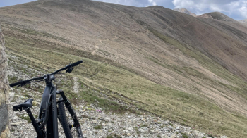
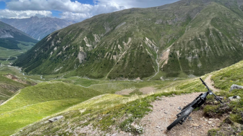
I arrive so nice and fresh at the ugly Cassana refuge, closed for years. I would also like to see who stays in this concrete thing to sleep instead of going down to Livigno or Engadine.
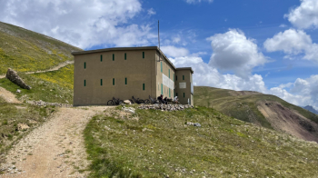
In fact, the trail that climbs to the left of the hut leads to the pass of the same name, and it was recently fixed as part of the maintenance of the trail down to the Engadine. I arrive at the pass and think back to the map I had photographed some time ago at Alpe Federia.
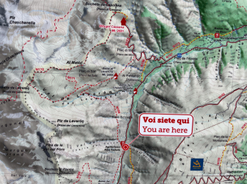
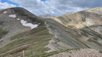
There are those ridges that appeal to me, they look completely cyclable, with the bike on batteries, and here I am improvising a route. It looks promising.
I arrive at a small house, bolted up, from which I can see the continuation of the trail. It turns out to be partly narrow and very slippery, but I pass it without much trouble.
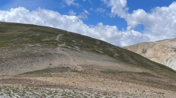
A path opens up before me that every biker dreams of: ridged, completely rideable.
Occasionally there are some white-red markers, and I continue the ride.
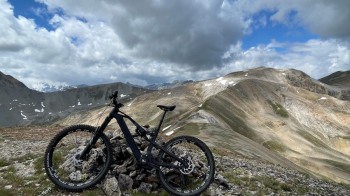
No one is around, great. Too bad the cairns disappear, as the trail is supposed to go left toward Val Federia but I can't find it. I get my bearings and decide to go for a freeride. You will see that my trail makes 2 attempts: I was looking for the trail that is not there. So I point to a saddle: on the right I go to Switzerland, on the left to Italy. Fortunately, even without a trail here it is all doable in the saddle. After quite a bit of freeriding I find a faded marker and follow some trail.
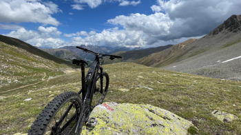
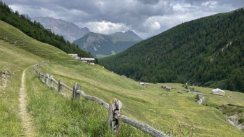
As I descend the trail becomes more and more obvious, I also meet some cows. Easier variation here. The trail is full of boulders in places, but all in all it is done almost all in the saddle. I see the valley at the bottom, with the dirt road leading to Alpe Federia.
I arrive at the civilization and merenderos, follow the road downhill for a while and then climb to the locality "The Walls," from where another trail starts, which shortly after goes into coniferous forest, descends to more houses and skirts the stream. I thus arrive at the asphalt road just outside Livigno and end the ride.
Tour to do by Ebike if you don't want to push hard on the ridge section, as well as mudslinging on the climb to Cassana.


