2022/08/04 20:53:52
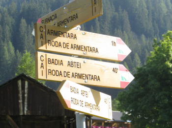
Badia - Santa Croce
Author
Place
Italy - Trentino-Alto Adige/Südtirol, BZ
Km
17,91 km
Elapsed time
03:13:55
Vertical meters
+830 mt (1325 - 2047)
Route difficulty
Landscapes
Last update
2023/01/03 17:03:04
Comments
Description
Tour done in August 2014, in the magnificent area of Alta Val Badia, starting from Badia. We continue towards San Leonardo and then through the villages of Valgiarei, Arciara and Furnacia until we take trail 15A that takes us to Rifugio Santa Croce, in the presence of Sass de la Creusc. The descent along Trail 7 takes us back to our starting point in a short time. Beware of numerous hikers. In the ?60s my uncle and his uncles used to leave from Livinallongo to get this far.
Topographic map Tabacco No. 7 Alta Badia - Arabba - Marmolada


Local weather
Oggi

19 °C
Stasera

8 °C
Domani

22 °C
Domani sera

9 °C
venerdì

16 °C
Venerdì notte

6 °C
Graph
Nearest Routes
24,35 km
Km
+700 mt
Vertical meters
Route difficulty
Landscapes
26,13 km
Km
+960 mt
Vertical meters
Route difficulty
Landscapes
25,21 km
Km
+880 mt
Vertical meters
Route difficulty
Landscapes
2023/02/26
- Italy - Trentino-Alto Adige/Südtirol, BZ 16,43 km
Km
+510 mt
Vertical meters
Route difficulty
Landscapes
2023/03/04
- Italy - Trentino-Alto Adige/Südtirol, BZ 33,04 km
Km
+2 120 mt
Vertical meters
Route difficulty
Landscapes
14,65 km
Km
+200 mt
Vertical meters
Route difficulty
Landscapes
34,62 km
Km
+1 720 mt
Vertical meters
Route difficulty
Landscapes
14,28 km
Km
+900 mt
Vertical meters
Route difficulty
Landscapes
40,94 km
Km
+2 230 mt
Vertical meters
Route difficulty
Landscapes
56,19 km
Km
+3 146 mt
Vertical meters
Route difficulty
Landscapes


 Italiano
 Deutsch