
 Italiano
 Deutsch
2023/03/06 08:39:29
Monte Maggio da Serrada
Author

Place
Italy - Trentino-Alto Adige/Südtirol, TN
Km
37,02 km
Elapsed time
07:36:55
Vertical meters
+1 000 mt (764 - 1827)
Route difficulty
Landscapes
Last update
2023/03/06 15:25:37
Comments
Description
Rather challenging but very enjoyable and scenic itinerary, discovering forts and trenches of the Great War.
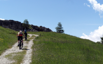
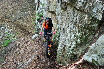
From Serrada you climb to Fort Dosso delle Somme, then descend to Passo Coe with steep and uneven parts. From here we climb to Mount Maggio on a challenging but rideable mule track. We continue south on narrow and partly exposed trail to Borcoletta and then descend to Borcola hut on nice technical trail.
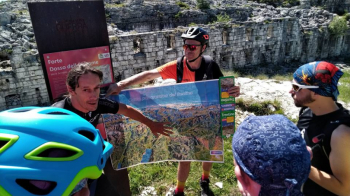
We continue on trail 11 to the junction with the sentier de la Stua. If conditions are good, you can continue left to Terragnolo and then climb back up to Stedileri, if not you go up (as on the trail) to the asphalt road and descend on asphalt. At Piazza go up to the right and return to Serrada.
Local weather

°C
°C
°C
°C
°C
°C
Graph
Nearest Routes
51,46 km
Km
+1 900 mt
Vertical meters
Route difficulty
Landscapes
59,43 km
Km
+2 200 mt
Vertical meters
Route difficulty
Landscapes
39,39 km
Km
+1 950 mt
Vertical meters
Route difficulty
Landscapes
45,29 km
Km
+1 850 mt
Vertical meters
Route difficulty
Landscapes
2023/03/02
- Italy - Trentino-Alto Adige/Südtirol, TN 31,15 km
Km
+1 470 mt
Vertical meters
Route difficulty
Landscapes
30,58 km
Km
+1 250 mt
Vertical meters
Route difficulty
Landscapes
51,67 km
Km
+2 500 mt
Vertical meters
Route difficulty
Landscapes
2025/06/07
- Italy - Trentino-Alto Adige/Südtirol, TN 46,43 km
Km
+2 050 mt
Vertical meters
Route difficulty
Landscapes
22,31 km
Km
+1 100 mt
Vertical meters
Route difficulty
Landscapes
27,93 km
Km
+900 mt
Vertical meters
Route difficulty
Landscapes