HOME RANKINGS CHALLENGES ROUTES NEAR ME PLANNING SEARCH LOGIN
Italy - Trentino-Alto Adige/Südtirol, BZ
2023/03/05 10:37:21

Giro del Ponte di Ghiaccio

4 Downloads
1
 
Share
Author
nonnocarb
(292)
Place
Italy - Trentino-Alto Adige/Südtirol, BZ
Km
36,54 km
Elapsed time
09:12:33
Vertical meters
+2 270 mt (1184 - 2552)
Route difficulty
Landscapes
Last update
2023/03/06 08:16:51
Comments
0
Description

Fantastic tour, both in terms of views and trails, but also very challenging, both in terms of elevation gain and the sections with bike on the back.
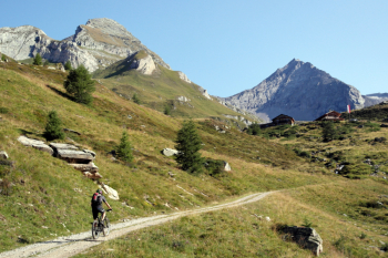
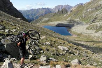
From Fundres you climb with increasingly beautiful views to the Gampiel hut. From here you enter the beautiful Ice Bridge valley and climb pedaling up to the malg ice bridge. From here with the bike on our backs we arrive at the beautiful lake and then at the Ice Bridge hut, where we can have something to eat, but from which we also escape fairly quickly, because it is too full of tourists after the peace of the first ascent.
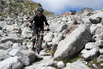
We descend to Lake Neves on challenging but fun trail, in high season full of hikers. After the lake we descend again on the rather challenging trail in places to the Neves Bridge.
From here the second ascent begins, rather steep, and after the last 300 meters on the shoulder we arrive at the pass fork, near the small lake of the same name, with beautiful views. The descent is nice up to the hut, then we have to go down a stretch on forestry, because the path is no longer accessible, then we take the nice path back to Fundres.

Download our free mobile app to send this route to your Garmin device or to navigate it on OSM maps. Android - iOS
Local weather
Tonight
-9 °C
Tomorrow
3 °C
Tomorrow night
-6 °C
Friday
4 °C
Friday night
-5 °C
Saturday
4 °C
Saturday night
-5 °C
Sunday
3 °C
Sunday night
-5 °C
Monday
2 °C

Graph

Nearest Routes

2023/02/26
- Italy - Trentino-Alto Adige/Südtirol, BZ
nonnocarb
(292)
29,44 km
Km
+1 110 mt
Vertical meters
Route difficulty
Landscapes
2024/01/24
- Italy - Trentino-Alto Adige/Südtirol, BZ
nonnocarb
(292)
6,98 km
Km
+400 mt
Vertical meters
Route difficulty
Landscapes
2024/01/24
- Italy - Trentino-Alto Adige/Südtirol, BZ
nonnocarb
(292)
31,93 km
Km
+1 100 mt
Vertical meters
Route difficulty
Landscapes
2022/10/30
- Italy - Trentino-Alto Adige/Südtirol, BZ
nonnocarb
(292)
80,29 km
Km
+2 211 mt
Vertical meters
Route difficulty
Landscapes
2024/11/08
- Italy - Trentino-Alto Adige/Südtirol, BZ
marco
(131)
25,71 km
Km
+1 308 mt
Vertical meters
Route difficulty
Landscapes
2023/03/04
- Italy - Trentino-Alto Adige/Südtirol, BZ
giobike73
(49)
54,04 km
Km
+1 320 mt
Vertical meters
Route difficulty
Landscapes
2023/10/20
- Italy - Trentino-Alto Adige/Südtirol, BZ
Scc
(3)
48,02 km
Km
+2 588 mt
Vertical meters
Route difficulty
Landscapes
2023/03/04
- Italy - Trentino-Alto Adige/Südtirol, BZ
nonnocarb
(292)
67,92 km
Km
+2 220 mt
Vertical meters
Route difficulty
Landscapes
2023/03/04
- Italy - Trentino-Alto Adige/Südtirol, BZ
giobike73
(49)
36,75 km
Km
+1 837 mt
Vertical meters
Route difficulty
Landscapes
2024/07/22
- Italy - Trentino-Alto Adige/Südtirol, BZ
nonnocarb
(292)
31,43 km
Km
+1 830 mt
Vertical meters
Route difficulty
Landscapes

0 Comments