2023/03/04 08:33:12
Sentieri da Lasa a Prato allo Stelvio
Author
Place
Italy - Trentino-Alto Adige/Südtirol, BZ
Km
45,04 km
Elapsed time
04:34:04
Vertical meters
+1 520 mt (867 - 1464)
Route difficulty
Landscapes
Last update
2023/03/04 18:34:27
Comments
Description
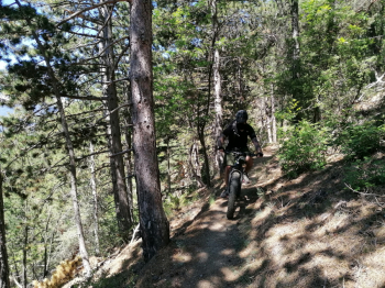
Very fun and scenic route even without reaching high altitudes, dedicated to bikers experienced in riding technical trails.

From Lasa you go towards Prato, at Cengles you climb to a forestry road at high altitude and then descend to Prato on a trail. You cross over to the other side of the valley, take a very narrow and exposed trail above Oris, then reach above Lasa and descend to Alliz (without descending and ascending, you can take the nice trail 18b that remains at altitude. You get to Tanas and descend on the beautiful but steep trail 18 to Lasa

Local weather

°C

°C

°C

°C

°C

°C
Graph
Nearest Routes
2023/06/01
- Italy - Trentino-Alto Adige/Südtirol, BZ 31,15 km
Km
+1 173 mt
Vertical meters
Route difficulty
Landscapes
47,18 km
Km
+1 500 mt
Vertical meters
Route difficulty
Landscapes
37,74 km
Km
+2 018 mt
Vertical meters
Route difficulty
Landscapes
54,32 km
Km
+2 227 mt
Vertical meters
Route difficulty
Landscapes
84,83 km
Km
+2 050 mt
Vertical meters
Route difficulty
Landscapes
2023/03/02
- Italy - Trentino-Alto Adige/Südtirol, BZ 40,98 km
Km
+1 980 mt
Vertical meters
Route difficulty
Landscapes
32,13 km
Km
+2 033 mt
Vertical meters
Route difficulty
Landscapes
72,93 km
Km
+2 970 mt
Vertical meters
Route difficulty
Landscapes
2024/01/10
- Italy - Trentino-Alto Adige/Südtirol, BZ 27,47 km
Km
+1 500 mt
Vertical meters
Route difficulty
Landscapes
2023/07/26
- Italy - Trentino-Alto Adige/Südtirol, BZ 28,35 km
Km
+1 500 mt
Vertical meters
Route difficulty
Landscapes


 Italiano
 Deutsch