HOME RANKINGS CHALLENGES ROUTES POI PLANNING SEARCH LOGIN
Italy - Trentino-Alto Adige/Südtirol, BZ
2023/03/02 19:02:44

Piz Chavalatsch da Prato allo Stelvio

5 Downloads
1
 
Share
Author
nonnocarb
(292)
Place
Italy - Trentino-Alto Adige/Südtirol, BZ
Km
40,98 km
Elapsed time
07:02:36
Vertical meters
+1 980 mt (902 - 2763)
Route difficulty
Landscapes
Last update
2023/03/02 21:43:53
Comments
0
Description

You go up toward Montechiaro and then by a long forest road through the forest you come to a junction with the alpine hut trail. You follow it to the Stelvio alpine hut. From here the old military trail to the Chavalatsch peak starts.
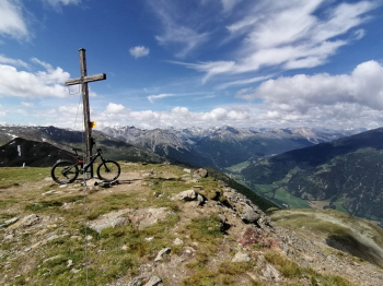
With normal bike you pedal partly and partly push, with e-bike you pedal almost all the way to the top, although with technical and steep sections. From the summit beautiful views of the Swiss mountains and the Venosta valley to Austria.
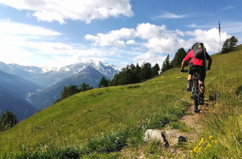
You then descend on the technical trail to the south, then climb again on the trail, almost all of it rideable by e-bike, to the Forcola hut. Before the refuge you descend on trail 7 to Stelvio village and then on the irrigation ditch trail, with a downhill walking section, to Prato.

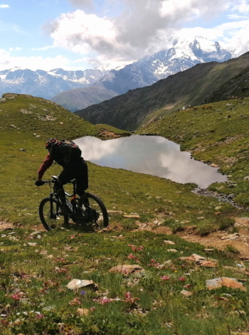
Spectacular route with magnificent views of the Ortles and Stelvio glaciers, for experienced and trained bikers used to some exposed trails.
Download our free mobile app to send this route to your Garmin device or to navigate it on OSM maps. Android - iOS
Local weather
Today
4 °C
Tonight
-3 °C
Tomorrow
10 °C
Tomorrow night
2 °C
Monday
10 °C
Monday night
6 °C
Tuesday
10 °C
Tuesday night
5 °C
Wednesday
9 °C
Wednesday night
5 °C

Graph

Nearest Routes

2023/03/04
- Italy - Trentino-Alto Adige/Südtirol, BZ
nonnocarb
(292)
84,83 km
Km
+2 050 mt
Vertical meters
Route difficulty
Landscapes
2022/09/01
- Italy - Trentino-Alto Adige/Südtirol, BZ
steve-U
(23)
37,74 km
Km
+2 018 mt
Vertical meters
Route difficulty
Landscapes
2022/09/24
- Italy - Trentino-Alto Adige/Südtirol, BZ
steve-U
(23)
54,32 km
Km
+2 227 mt
Vertical meters
Route difficulty
Landscapes
2023/03/07
- Italy - Trentino-Alto Adige/Südtirol, BZ
nonnocarb
(292)
47,18 km
Km
+1 500 mt
Vertical meters
Route difficulty
Landscapes
2023/03/04
- Italy - Trentino-Alto Adige/Südtirol, BZ
nonnocarb
(292)
85,06 km
Km
+2 720 mt
Vertical meters
Route difficulty
Landscapes
2023/03/07
- Italy - Trentino-Alto Adige/Südtirol, BZ
nonnocarb
(292)
23,08 km
Km
+1 700 mt
Vertical meters
Route difficulty
Landscapes
2024/09/11
- Italy - Trentino-Alto Adige/Südtirol, BZ
Staff
(77)
24,82 km
Km
+1 700 mt
Vertical meters
Route difficulty
Landscapes
2024/01/02
- Italy - Trentino-Alto Adige/Südtirol, BZ
@ff.mtb
(9)
44,55 km
Km
+1 700 mt
Vertical meters
Route difficulty
Landscapes
2023/03/05
- Italy - Trentino-Alto Adige/Südtirol, BZ
nonnocarb
(292)
37,16 km
Km
+1 730 mt
Vertical meters
Route difficulty
Landscapes
2024/02/21
- Italy - Lombardia, SO
ValeBG
(139)
98,09 km
Km
+6 000 mt
Vertical meters
Route difficulty
Landscapes

0 Comments