2023/03/01 14:59:09
Da Verona a Montecchio
Author
Place
Italy - Veneto, VR
Km
38,02 km
Elapsed time
03:26:39
Vertical meters
+550 mt (55 - 511)
Route difficulty
Landscapes
Last update
2023/03/01 17:11:56
Comments
Description
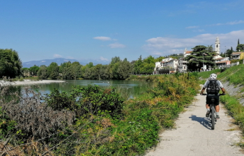
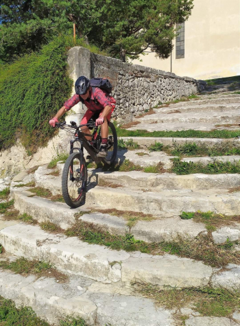
Fun and scenic route in the pre-Alps just outside Verona, with fairly challenging climbs and beautiful trails through dense forest.

You leave Verona along the Adige River and then reach Avesa. From here you start to climb and by small roads and trails you reach Montecchio.
Then long paths in the woods up and down to Quinzano and last descent to the beautiful church of San Rocco. Return to Verona on ciclablie and along the Adige.

Local weather

°C

°C

°C

°C

°C

°C
Graph
Nearest Routes
25,80 km
Km
+900 mt
Vertical meters
Route difficulty
Landscapes
26,71 km
Km
+860 mt
Vertical meters
Route difficulty
Landscapes
25,00 km
Km
+712 mt
Vertical meters
Route difficulty
Landscapes
19,40 km
Km
+619 mt
Vertical meters
Route difficulty
Landscapes
30,41 km
Km
+850 mt
Vertical meters
Route difficulty
Landscapes
20,47 km
Km
+735 mt
Vertical meters
Route difficulty
Landscapes
43,67 km
Km
+1 282 mt
Vertical meters
Route difficulty
Landscapes
2023/06/12
- Italy - Veneto, VR 24,78 km
Km
+930 mt
Vertical meters
Route difficulty
Landscapes
17,89 km
Km
+740 mt
Vertical meters
Route difficulty
Landscapes
20,18 km
Km
+715 mt
Vertical meters
Route difficulty
Landscapes


 Italiano
 Deutsch