2023/02/26 21:55:59
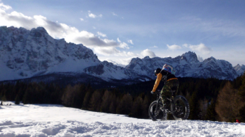
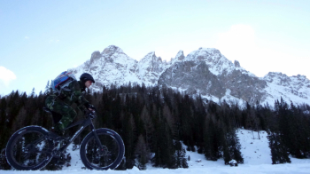
Nemes e Croda Rossa sulla neve
Place
Italy - Trentino-Alto Adige/Südtirol, BZ
Km
22,50 km
Elapsed time
03:14:28
Vertical meters
+850 mt (1349 - 1929)
Route difficulty
Landscapes
Last update
2023/12/04 13:40:47
Comments
Description
Very scenic route doable throughout the year, quite easy in summer and rather hard in winter, when ideally to be completed would be to have a fat bike or e-bike plus.

Also, in winter, you have to wait until the #fresh snow is well groomed or better hard, so that you will be able to ride with less difficulty. From Moso one climbs to the Nemes alpine hut with some rather steep sections. From the hut you descend to the Montecroce Pass and from there climb to the Croda Rossa. From here you descend on path 153, this is the most challenging part of the trail, as the path is narrow but still not technical. Then you return to the parking lot on the beautiful Fiscalina Valley Trail 1.

Local weather

°C

°C

°C

°C

°C

°C
Graph
Nearest Routes
17,34 km
Km
+1 000 mt
Vertical meters
Route difficulty
Landscapes
2022/09/17
- Italy - Trentino-Alto Adige/Südtirol, BZ 41,63 km
Km
+1 879 mt
Vertical meters
Route difficulty
Landscapes
30,41 km
Km
+1 000 mt
Vertical meters
Route difficulty
Landscapes
44,46 km
Km
+1 400 mt
Vertical meters
Route difficulty
Landscapes
2023/02/26
- Italy - Trentino-Alto Adige/Südtirol, BZ 24,89 km
Km
+790 mt
Vertical meters
Route difficulty
Landscapes
2023/03/06
- Italy - Trentino-Alto Adige/Südtirol, BZ 29,85 km
Km
+1 700 mt
Vertical meters
Route difficulty
Landscapes
30,63 km
Km
+1 400 mt
Vertical meters
Route difficulty
Landscapes
135,06 km
Km
+3 800 mt
Vertical meters
Route difficulty
Landscapes
47,62 km
Km
+1 550 mt
Vertical meters
Route difficulty
Landscapes
43,07 km
Km
+1 550 mt
Vertical meters
Route difficulty
Landscapes


 Italiano
 Deutsch