Velva e Monte Moneglia
For bike backpackers and technical sea view lovers.
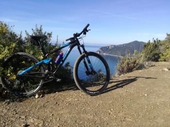
The trail starts from Chiavari, until Sestri it follows the Aurelia and is transfer only, it is nice the path above the rocche di Sant'Anna that allows you to avoid the tunnel, but it is avoidable if you prefer to save elevation gain. From Sestri follow the signs for Casarza Ligure and start climbing on asphalt, this part is avoidable with the bike path from Casette Rosse park to the center of Casarza. Continue on asphalt following for Castiglione Chiavarese, pass the village and before Missano take a left uphill, towards the Misericordia sanctuary and Monte Crosa. Here the gradients become challenging, particularly the final straight. Leave the asphalt and take a right on dirt road downhill to Fascette and come out of the sanctuary of Velva; there is a fountain in front of the church. Coming out of the church square keep left and then after 20 m take a path to the right. Be careful to take the path furthest to the right. After several ups and downs you reach the asphalt road, cross it and take the dirt road on the right downhill, sik follow it and keeping left at the next junction, where a transfer on flat single track begins, you arrive at Cian di Vasca, where the path comes out on a dirt road, which you follow on a false level downhill to the right. At the end of the dirt road you come out on asphalt near the village of Bracco, take a downhill right and follow the main road all the time. After a short uphill rinse, at the top you leave the asphalt for a path to the left, follow the signs to Monte Moneglia. Here begins the hard part of the tour, 200 m of elevation gain with a few pedaled sections and a single obvious fork where you follow a right to Monte Moneglia. At the top of the first fork we take a right, at the second important one we descend to the left, beginning a very technical trail with unparalleled views. The trail comes out at the beginning of the PS U TURIUN, at the end of the trail follow to the left and you will come to a small clearing with picnic tables, proceed straight up the ridge with a view that sweeps from Mount Portofino to Punta Mesco. Be careful to take a right at the next two forks, the trail widens and you can stop to admire the view.

After the uphill relaunch the dirt road starts to descend again, make the cut into the hairpin bend and then take a right onto the path that passes near the abandoned bunker.
Enjoy this last bit of trail, eventually take on the asphalt to the left and you will reach the Riva cemetery, descend to the right and from here return to the starting point.
Leave some energy for the last part that challenging both uphill and downhill, take the first piece up to the Bracco as a warm-up.


 Italiano
 Deutsch