HOME RANKINGS CHALLENGES ROUTES NEAR ME PLANNING SEARCH LOGIN
Italy - Trentino-Alto Adige/Südtirol, TN
2022/12/13 17:59:47

Pale di San Martino e discesa in Val Gares

1084 Downloads
31
 
Share

Key Takeaways / Scheda Tecnica

Disciplina:
Mountain Bike (MTB)
Percorso:
Pale di San Martino e discesa in Val Gares
Località:
Italy - Trentino-Alto Adige/Südtirol, TN
Distanza:
49,88 km
Dislivello Positivo:
+1 025 mt (Quota Min: 971m - Max: 2653m)
Difficoltà Tecnica:
3/5
Valutazione Panorami:
5/5
Formato Traccia:
GPX Download disponibile
Author
Staff
(110)
Place
Italy - Trentino-Alto Adige/Südtirol, TN
Km
49,88 km
Elapsed time
05:44:23
Vertical meters
+1 025 mt (971 - 2653)
Route difficulty
Landscapes
Last update
2026/07/24 19:08:51
Comments
4
Description

A fabulous hike through the lunar landscape of the Pale (accessible via the Rosetta cable car); the trail descending into Val Gares is beautiful and challenging; to bypass part of Passo Valles, take a second cable car; the ascent from Val Venegia to Baita Segantini also offers remarkable scenery. The route starts at the Eden Campground in Falcade, strategically located right across from the cable car we’ll be taking (though you can start from any point along the route). It’s very peaceful, situated next to a stream. It has campsites up on the hill where you can get a great night’s sleep.
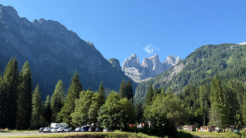
Foto itinerario MTB Pale di San Martino e discesa in Val Gares - Italy - Trentino-Alto Adige/Südtirol, TN

We take the cable car and then the chairlift, which take us to Laresei for 12 euros (bikes included). From here, we descend to the Valles Pass via shortcuts that shorten the dirt road. From the pass, a push-your-bike section begins all the way to the Venegia Saddle, with a short stretch of pedaling in between.
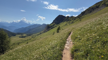
Foto itinerario MTB Pale di San Martino e discesa in Val Gares - Italy - Trentino-Alto Adige/Südtirol, TN

We quickly reach the Venegia Pass, where the spectacular view of the Val Venegia and the Pale di San Martino opens up before us.
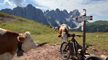
Foto itinerario MTB Pale di San Martino e discesa in Val Gares - Italy - Trentino-Alto Adige/Südtirol, TN

We take a trail that’s been somewhat trampled by cows, which then leads into the woods and becomes more enjoyable.
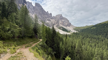
Foto itinerario MTB Pale di San Martino e discesa in Val Gares - Italy - Trentino-Alto Adige/Südtirol, TN

It leads us out onto the Val Venegia dirt road, which we follow uphill to Baita Segantina. There are many hikers here, or “merenderos.” That’s why we follow the dirt road to Passo Rolle, because the trails are crowded and, on top of that, are off-limits to bikes (understandably, given the traffic).
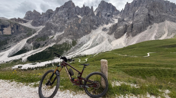
Foto itinerario MTB Pale di San Martino e discesa in Val Gares - Italy - Trentino-Alto Adige/Südtirol, TN

From Passo Rolle, we initially follow the paved road, then take the bike trail that will cross the pass road several times before taking us to San Martino di Castrozza. It’s time to take the second cable car—or rather, two cable cars—which, for 26 euros, will take us up to the Rosetta Plateau, in the heart of the Pale.
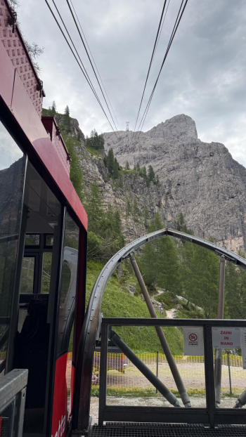
Foto itinerario MTB Pale di San Martino e discesa in Val Gares - Italy - Trentino-Alto Adige/Südtirol, TN

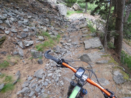
Here, too, we’ll find many hikers, though they disappear entirely once we pass the Rosetta Mountain Hut. From that point on, the peace will be absolute. The trail is a gently sloping military path, but it’s entirely made of rock and loose stones.
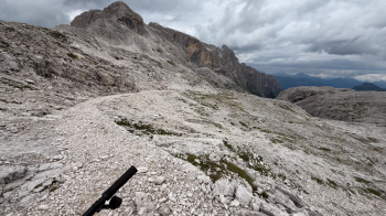
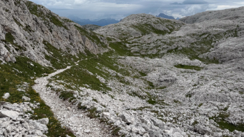
Foto itinerario MTB Pale di San Martino e discesa in Val Gares - Italy - Trentino-Alto Adige/Südtirol, TNFoto itinerario MTB Pale di San Martino e discesa in Val Gares - Italy - Trentino-Alto Adige/Südtirol, TNFoto itinerario MTB Pale di San Martino e discesa in Val Gares - Italy - Trentino-Alto Adige/Südtirol, TN

Apart from a few short sections, the rest is very easy and one-of-a-kind. There are a couple of ups and downs—which are also rideable—until you start descending toward Val Gares. Here there are some exposed sections, but the trail is wide and can be ridden without any problems.
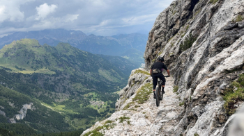
Foto itinerario MTB Pale di San Martino e discesa in Val Gares - Italy - Trentino-Alto Adige/Südtirol, TN

After several kilometers, we finally reach dirt, and the trail becomes more streamlined, despite having collapsed in several places (EDIT: the landslides were repaired in the summer of 2026). In the photo below, you can see Val Gares all the way to the left, which is our destination.
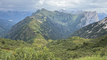
Foto itinerario MTB Pale di San Martino e discesa in Val Gares - Italy - Trentino-Alto Adige/Südtirol, TN

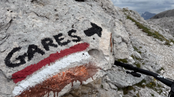
At the Campigat mountain hut, at 1,800 meters, there’s a beautiful fountain. Here, we keep to the left; the trail now enters the woods and becomes more challenging.
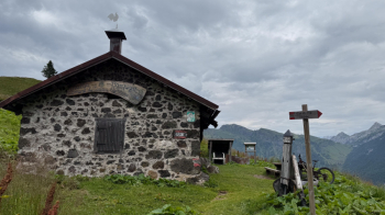
Foto itinerario MTB Pale di San Martino e discesa in Val Gares - Italy - Trentino-Alto Adige/Südtirol, TN

It’s very well maintained, although some wooden steps make it a bit difficult to ride your bike. The forest setting, however, is very beautiful.
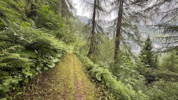
Foto itinerario MTB Pale di San Martino e discesa in Val Gares - Italy - Trentino-Alto Adige/Südtirol, TN

The descent is really long, and you’ll be glad when you reach Gares, where we’ll first follow a dirt road and then the paved road all the way to Canale d’Agordo. From there, an uphill dirt road will take us back to the starting point after an elevation gain of about 150 meters.

The elevation gain covered by bike is 1,025 meters. The rest is covered by cable car.


Download our free mobile app to send this route to your Garmin device or to navigate it on OSM maps. Android - iOS
Local weather
Mar 00:00
8 °C
Mar 12:00
10 °C
Mer 00:00
9 °C
Mer 12:00
11 °C
Gio 00:00
8 °C
Gio 12:00
6 °C
Ven 00:00
4 °C
Ven 12:00
8 °C
Sab 00:00
3 °C
Sab 12:00
2 °C

Graph

Nearest Routes

2022/08/12
- Italy - Veneto, BL
gmzolenart
(137)
18,78 km
Km
+873 mt
Vertical meters
Route difficulty
Landscapes
47,96 km
Km
+1 788 mt
Vertical meters
Route difficulty
Landscapes
2026/08/05
- Italy - Trentino-Alto Adige/Südtirol, TN
Paoloc1
(135)
53,36 km
Km
+3 000 mt
Vertical meters
Route difficulty
Landscapes
2023/03/09
- Italy - Trentino-Alto Adige/Südtirol, TN
civi65
(106)
38,63 km
Km
-2 300 mt
Vertical meters
Route difficulty
Landscapes
2026/08/10
- Italy - Trentino-Alto Adige/Südtirol, TN
Paoloc1
(135)
36,50 km
Km
+1 800 mt
Vertical meters
Route difficulty
Landscapes
2024/01/02
- Italy - Trentino-Alto Adige/Südtirol, TN
@ff.mtb
(9)
53,65 km
Km
+1 800 mt
Vertical meters
Route difficulty
Landscapes
2025/09/19
- Italy - Trentino-Alto Adige/Südtirol, TN
30,55 km
Km
+1 550 mt
Vertical meters
Route difficulty
Landscapes
2023/02/26
- Italy - Trentino-Alto Adige/Südtirol, TN
nonnocarb
(324)
17,68 km
Km
+770 mt
Vertical meters
Route difficulty
Landscapes
2023/02/26
- Italy - Trentino-Alto Adige/Südtirol, TN
nonnocarb
(324)
19,49 km
Km
+790 mt
Vertical meters
Route difficulty
Landscapes
2023/07/17
- Italy - Trentino-Alto Adige/Südtirol, TN
gmr
(4)
42,95 km
Km
+1 500 mt
Vertical meters
Route difficulty
Landscapes

4 Comments