HOME RANKINGS CHALLENGES ROUTES NEAR ME PLANNING SEARCH LOGIN
Italy - Liguria, SP
2026/10/05 18:40:22

Bandia da Bonassola

1 Downloads
0
 
Share

Key Takeaways / Scheda Tecnica

Disciplina:
Mountain Bike (MTB)
Percorso:
Bandia da Bonassola
Località:
Italy - Liguria, SP
Distanza:
43,69 km
Dislivello Positivo:
+1 464 mt (Quota Min: 7m - Max: 596m)
Difficoltà Tecnica:
4/5
Valutazione Panorami:
5/5
Formato Traccia:
GPX Download disponibile
Author
Antosangui
(121)
Place
Italy - Liguria, SP
Km
43,69 km
Elapsed time
04:04:24
Vertical meters
+1 464 mt (7 - 596)
Route difficulty
Landscapes
Last update
2026/10/05 18:48:29
Comments
0
Description

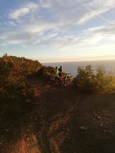
Route starting from Bonassola to reach the Bandia trails. From downtown Bonassola, take the seaside bike path to Levanto, where you’ll climb on paved road to the Gritta Pass. From there, continue climbing to the left until you reach the Soviore Sanctuary, where you’ll leave the main paved road and take a side road on the left. After a challenging climb, you’ll reach the summit and turn right onto a paved road. After a few kilometers, leave the paved road and take a dirt road on the left, which winds up and down and leads to the start of the first trail.
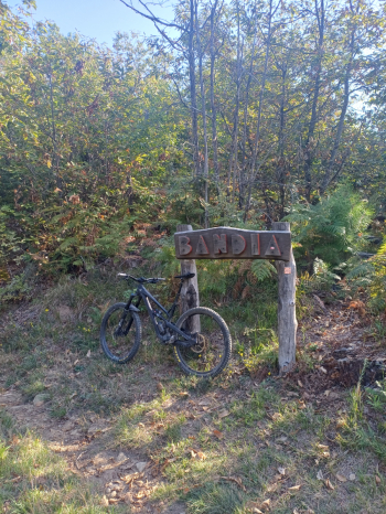
Foto itinerario MTB Bandia da Bonassola - Italy - Liguria, SP

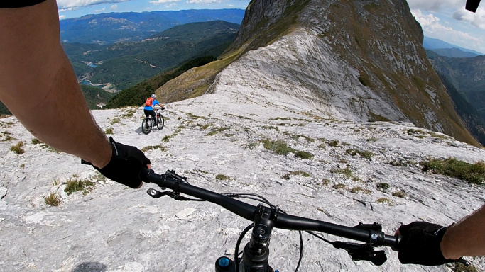
Take the trail leading toward Pignone—a wonderful discovery. It’s very “flowy” and well-maintained, with some great sections. Once you reach Pignone, there are two fast trails in quick succession. Return to the village and take the paved road toward the Termine Pass; the gradient is gentle. After a few kilometers, turn right; the slope steepens, and you’ll reach the area above Soviore once again. Take the Crocettola trail on the right, and the flow disappears—it’s back to the familiar Ligurian rock. Once back at Colla di Gritta, take the trail behind the restaurant toward Cima Rossini, where the view of the Cinque Terre is always spectacular.
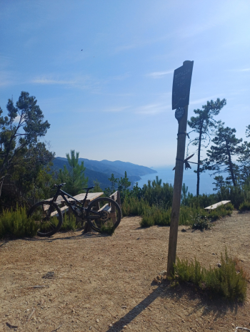
Foto itinerario MTB Bandia da Bonassola - Italy - Liguria, SP


Descend along the trail to Levanto, where you’ll take the bike path back to Bonassola. I recommend doing this route during the off-season, due to the heat and the presence of hikers, especially during the last part of the ride.

Download our free mobile app to send this route to your Garmin device or to navigate it on OSM maps. Android - iOS
Local weather
Tue 00:00
18 °C
Tue 12:00
22 °C
Wed 00:00
20 °C
Wed 12:00
20 °C
Thu 00:00
19 °C
Thu 12:00
20 °C
Fri 00:00
10 °C
Fri 12:00
19 °C
Sat 00:00
16 °C
Sat 12:00
16 °C

Graph

Nearest Routes

2026/05/02
- Italy - Liguria, SP
Antosangui
(121)
41,76 km
Km
+1 467 mt
Vertical meters
Route difficulty
Landscapes
2023/03/03
- Italy - Liguria, SP
Antosangui
(121)
6,02 km
Km
0 mt
Vertical meters
Route difficulty
Landscapes
2023/02/24
- Italy - Liguria, SP
Antosangui
(121)
46,36 km
Km
+1 618 mt
Vertical meters
Route difficulty
Landscapes
2025/04/20
- Italy - Liguria, SP
lcast
(7)
54,04 km
Km
+1 455 mt
Vertical meters
Route difficulty
Landscapes
2023/03/03
- Italy - Liguria, SP
Antosangui
(121)
24,20 km
Km
+1 009 mt
Vertical meters
Route difficulty
Landscapes
2023/07/18
- Italy - Liguria, SP
ebsat
(129)
24,23 km
Km
+1 110 mt
Vertical meters
Route difficulty
Landscapes
2024/12/15
- Italy - Liguria, SP
Antosangui
(121)
38,57 km
Km
+1 224 mt
Vertical meters
Route difficulty
Landscapes
2024/12/26
- Italy - Liguria, SP
Antosangui
(121)
35,34 km
Km
+1 292 mt
Vertical meters
Route difficulty
Landscapes
2025/01/25
- Italy - Liguria, SP
Antosangui
(121)
32,21 km
Km
+1 228 mt
Vertical meters
Route difficulty
Landscapes
2023/03/10
- Italy - Liguria, SP
Antosangui
(121)
22,85 km
Km
+1 141 mt
Vertical meters
Route difficulty
Landscapes

0 Comments