Italiano
 Deutsch
La tre colli del Ceresio

A route with three climbs and three descents on the peninsula stretching from Lugano to Morcote. Ideal for XC bikes or other bikes with limited travel, since the trails aren’t difficult and you’ll have a lot of fun on them.
The route starts in Breganzona, but it’s even better to start at Lake Muzzano, where there’s a large paid parking lot. You’ll climb toward Collina d’Oro—specifically to Gentilino—and then descend over a short singletrack to Pambio. You’ll descend on asphalt to the highway entrance and then climb the opposite hill toward Pazzallo, still on asphalt. From Pazzallo, we take an uphill trail with a few technical sections that leads us to Carabbia. We cross the village and begin the long traverse that will take us just below Torello, after several very fun ups and downs.
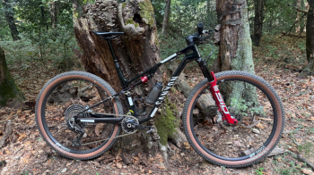
In Torello, we catch our breath for a moment before beginning the descent toward Arbostora. Never steep, it has a few ups and downs and a couple of rocky sections. By now, we can catch glimpses of the lake through the trees to our side. The trail drops us off in Arbostora, where we continue on paved road to Morcote, a small village that’s always quite crowded with tourists arriving by boat. We continue along the lakeshore on paved road, and at the first fork we turn left toward Carona. This is the classic climb for road bikes, offering beautiful views of the lake. At the last hairpin turn, we turn left toward Alpe Vicania, still on paved road, and as soon as we crest the hill, we take a rather bumpy dirt road to the right that leads us to this scenic viewpoint overlooking the lake.
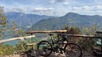
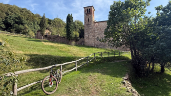
A mandatory break is in order before finishing the climb by switching sides and taking a nice trail through the woods that leads onto one of Carona’s small trails, maintained by the local kids. All the descents have a maximum difficulty of S2, and all the jumps on this section can be avoided. We arrive at a dirt road that we follow to the left toward the church of S. Maria D’Ongero. We continue down a fast descent until we reach Torello again, where a few steps next to the house will take us back to the trail we took earlier.
We retrace the same descent as before to Arbostora, where this time we turn right to reach the lake and follow the paved road along its shore to Figino. From there, we leave the lake behind, head to Cadepiano, and begin the climb to Agra, passing through Barbengo—all on paved road. In Agra, we head to the highest point, near Grotto Posmonte, where our descent begins on a trail—first to Montagnola and then, after a stretch on paved road, to Viglio. We are now just a stone’s throw from Lake Muzzano. From here, we can either climb back up to Breganzona or head to the lake’s parking lot to finish the ride.