
 Italiano
 Deutsch
Capriasca e Malcantone

Spectacular ride that starts in Lugano and touches two areas full of beautiful trails. It can be done even with an XC or trail with little hike. Start in Breganzona (free parking on weekends directly where the trail starts or at the elementary schools) and quiet start on back roads and on the bike path to Tesserete along the old railroad route. From Tesserete you descend to Origlio on a fast, rocky trail. Pass by the small lake of the same name and climb toward San Zeno on comfortable dirt road that becomes steep only below the church. View of the Vedeggio valley that deserves a break.
From here begins an up-and-down trail, very flowy with lots of relaunches, before becoming more challenging toward the end. Short stretch on dirt road and then back on trail, fast and fun, that brings us to the cantonal road. We cross it, pass under the railroad using the Taverne station and head on back roads to Torricella. Here begins the hardest part of the ride, namely the climb up to the Torricella Mountains. A steep asphalt road but nestled in a beautiful chestnut forest, cool in summer. It is bikeable only uphill, partly because it would be a sacrilege to descend on asphalt with all the available trails.
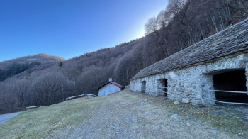
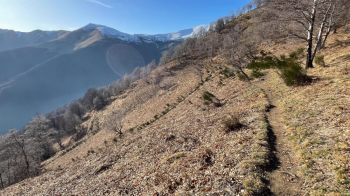
You pass the Torricella Mountains (if you are tired take to Arosio following this trail, which joins this one at Arosio) and continue uphill, now less steep, until you reach Alpe di Torricella.
From here we take a trail that is all rideable in the saddle, except for a point in the final hairpin bend, which takes us to La Bassa, where the descent begins. Mount Ferraro, on whose western slopes we will descend, burned in February 2024, but fortunately the trail suffered no notable damage except for a tree and a few branches that will be removed in the spring.
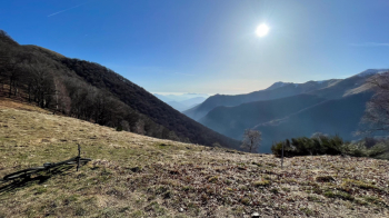
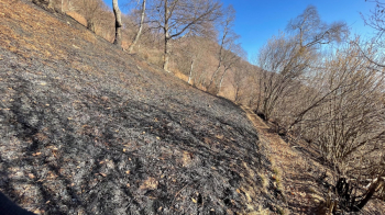
Be careful in winter because the beech leaves in the first part are very slippery when dry, the rest at the moment (February 2024) is clean as a whistle. The trail is challenging in places, but with a little confidence it can all be done.
Once you come out on the dirt road you follow it for about a hundred meters and take a dirt and narrow goat path to the right (if you don't want to do this continue on the dirt road which then becomes asphalt, it joins the trail at Arosio). Nothing difficult, but it is slow and watch out for branches and a few landslide parts.
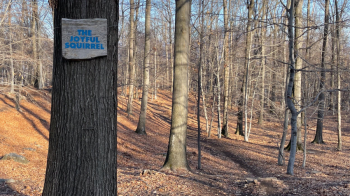
At Arosio we go up to the Sgambada grotto and continue to the Black Deer Project trails. We take the most flowing, The Joyful Squirrel, because it is the one that leads us towards Cademario. Fast, with a few jumps and banks, a real delight even with an XC.
We come out on the official Cademario-Arosio trail, take a right and reach Cademario (alternatively, for a nicer but more technical and not really XC descent, return to Grotto Sgambada and follow this trail to Gravesano). From here we continue on the ridge, first on a dirt road and then on a nice trail that takes us all the way down below Monte Santa Maria. We take a cart track that is nothing special, disembark at Cimo, follow the asphalt and then a trail that passes between houses (go slow!). You then take the Righetti descent, first on a dirt road and then on an unmarked trail: be very careful with the GPS track otherwise you will miss the left fork downhill. This path, after a gate, has been cleaned and is short but nice. It comes out near Agno, where in summer the lake invites a swim (it also rhymes), and then goes up to Breganzona first on bike path and then on back roads.


