Italiano
 Deutsch
Sella Ronda in Ebike senza impianti
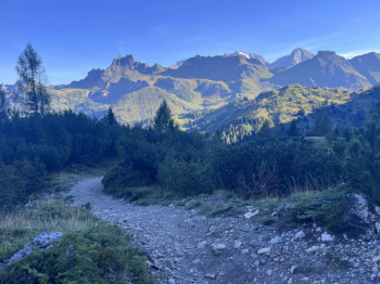
Generally speaking, the route follows the classic Sellaronda route in a clockwise direction, but with numerous variations designed to prioritize technical descents, minimize paved sections as much as possible, and, above all, follow rideable trails and dirt roads for the climbs. The result is a particularly rewarding route, extremely varied and set in scenery that, in terms of landscape, has very few rivals. But there’s also a second challenge, one entirely related to managing battery life: you need to carefully pace your pedal assist during the climbs to complete the entire loop without needing to recharge. In my case, the bike was equipped with an 850 Wh Bosch battery. The route starts in Arabba, taking the gentle and pleasant forest road that climbs toward Pordoi. Once past Ponte de Vauz, the climb becomes progressively more challenging, and the forest road gives way to a trail—at times a single track—with some decidedly tough stretches. At several points, you’ll cross the MTB trail descending from Pordoi, but you can avoid it by sticking to the hiking trail.
Once you reach Pordoi, you’ll tackle the steep climb that leads over the ridge just below Col di Rosc, the starting point for the trails descending toward Canazei. The battery is still at 90%. At an elevation of 2,360 meters, there’s a wide variety of options to suit every taste. We start with U Turn, a classic trail: fast, extremely smooth, with breathtaking parabolic turns and jumps that invite you to let the bike run free. Even the dirt surface is perfectly smooth. In the second section, the trail becomes a bit more technical, with a few sections over rocks and roots, but it remains remarkably smooth throughout, with difficulty levels ranging from S1 to S2. In the final stretch, I choose the Animal House/Infinity alternative, which is decidedly more natural: technical sections, steps, roots, steep descents, and almost trial-style sections, for an S2 difficulty level. If you follow the signs for the Gluhwein (Mulled Wine) variant, however, you’ll also encounter S3-level sections. There are a few short uphill sections, but they’re absolutely worth it in light of the upcoming descent, which takes us to the Lupo Bianco pond at an elevation of 1,715 meters.
Here begins a new climb—long but easily rideable—toward Passo Sella. A few steep sections mark the beginning, while the middle section levels out, giving way to the final ramp that takes you over the pass just above Sella. The battery is at 75%. After a short descent, we rejoin the Sellaronda trail, which takes us to an elevation of about 2,200 meters, where we meet the fast GranParadiso Trail, classified as S1. The trail leads to the Piz Setus Mountain Hut and, a little further down, offers a couple of trails heading toward Plan de Gralba. We choose the Easy Jump, which is more acrobatic and decidedly playful, featuring descents, compressions, jumps, and breathtaking parabolic turns. It’s a real amusement park roller coaster, rated S2. Once you reach Plan de Gralba, there’s a new variation from the classic Sellaronda route—necessary to avoid what I consider the dull descent toward Santa Cristina. The trade-off is a climb of about 300 meters in elevation gain to reach the Ciampinoi DH, but it’s definitely worth it. The climb is long and fairly gradual, with a few steep sections, but always easy to pedal. As soon as you crest the hill, just below the Ciampinoi lift’s top station, the DH begins. My battery is at 60%.
The trail is in excellent condition, very fun, and rewarding. It doesn’t feature any impossible technical sections and offers a well-balanced mix of steps, steep sections with rocks and roots, banked turns, and jumps. There’s something for everyone, including some more acrobatic jumps—though they’re easily avoidable. At Santa Cristina, we’re about halfway through the total elevation gain of the route: this is therefore the right time to carefully check the battery level and make sure it’s sufficient to complete the ride without recharging. In my case, I arrived here with 60% battery remaining. From Santa Cristina, a new, extremely tough climb begins toward Dantercepies: a long, rideable dirt road with a few short steep sections, but nearly 700 meters of elevation gain to tackle. At the end of the climb, the battery level had dropped to 44%. Once over the pass, you take the beautiful Giara trail, heading toward the Gardena Pass. It’s a varied and well-designed trail that combines speed and technical skill: steep sections, parabolic turns, jumps, and a few stretches with more natural terrain, rated S1-S2 in difficulty. On the final stretch, it’s best to keep to the left to avoid a short climb on asphalt up to the Gardena Pass. This way, you’ll directly join the trail that descends toward Corvara, the Frara. This is also a fun route, slightly more nature-oriented, with a surface featuring rocks and stones in some sections and a fairly varied course. Difficulty: S1. In the final section, I choose a variation from the classic Sellaronda route to avoid a stretch on paved road in the Corvara area, opting instead for the path on the left, with sections of singletrack and dirt road leading to the ski lift area.
Now we face the new and final long climb toward the ridge leading to the Pralongià Mountain Hut. The first section is on asphalt, then it switches to a dirt road, with a moderate to steep grade in the final stretch. Once past the climb, we find ourselves on the long, spectacular ridge, marked by a few ups and downs and a simply magnificent view. At Pralongià, the battery is at 28%. This is where the Flè Trail begins, featuring long wooden walkways, which reaches Passo Incisa and continues until it intersects with CAI Trail 26. It’s a beautiful route through the woods, though there are a few climbs before reaching the forest road/trail that leads just below Passo Campolongo. Here, too, there’s an alternative route that lets you reach Campolongo from above, avoiding a less interesting section. You’ll face a tough climb on CAI 26—fortunately a short one—which leads to a junction with CAI 3 in the final stretch, continuing on to 3A. From here begins the beautiful, technical singletrack that’s definitely worth taking and allows you to reach Campolongo from above.
It’s the last tough climb of the day, but with the remaining battery power, you can still tackle it with a good amount of pedal assist. This quickly brings you to the Bec de Roces Mountain Hut, where the day’s final spectacular descent begins, heading toward Arabba. The route strikes an excellent balance between a classic bike park trail and a natural trail. The first part is decidedly “flow,” with hairpin turns and curves featuring perfectly connected berms, allowing you to let the bike roll with great fluidity. Difficulty: S1. Further down, the terrain gradually changes character: small rocks and steps appear, and the difficulty rises to S2, without, however, losing that pleasant flow that makes this section particularly fun.
This brings you to the Plan Boè Mountain Hut. An important note: this section, as well as the next one, is shared by mountain bikers and hikers. There may be a significant number of pedestrians, so it’s essential to moderate your speed and always yield to hikers when necessary. The trail continues with a decidedly “flow” feel, interspersed with a few technical sections that do not exceed S2 difficulty, all the way to the finish in Arabba.
A Sellaronda that’s completely different from the classic loop using the lifts: longer, physically demanding, and above all much more varied, yet offering a succession of descents, alternative routes, and panoramic views that transform the tour into a true day of alpine freeriding on an e-bike, where managing your battery becomes an integral part of the challenge.