Italiano
 Deutsch
Dal Passo Campolongo ad Alleghe
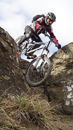
From Campolongo to Alleghe: a mountain bike traverse through the Sella, Padon, and Agordina valleys. A spectacular traverse, almost entirely off-road, that leads from the Campolongo Pass to Alleghe, passing through some of the most breathtaking scenery in the Dolomites. There’s practically no paved road—just a few dozen meters on secondary roads—while the route offers a surprising variety of terrain and riding styles: groomed trails, natural trails, Alpin Bike, technical sections, and fun freeride stretches, all accompanied by first-rate views. Completed on an e-bike.
The ride starts at Campolongo Pass, immediately tackling the tough dirt climb leading to the Bec de Roces Mountain Hut. Here begins one of the most enjoyable stretches of the traverse, part of the Sellaronda MTB route and offering an excellent balance between classic grooved trails and natural trails. The first part is decidedly flowy, with hairpin turns and curves featuring perfectly connected berms that let you let the bike roll with great fluidity (S1). Further down, the terrain gradually changes character: small rocks and steps appear, with the difficulty rising to S2, but without losing that pleasant flow that makes this segment particularly fun. This brings you to the Plan Boè Mountain Hut. An important reminder: this section and the next are shared by cyclists and hikers. There may be a significant number of pedestrians, so it’s essential to moderate your speed and always yield to hikers when necessary.
The trail continues with a distinctly “flow” feel, interspersed with a few technical sections that do not exceed S2 difficulty, all the way to Arabba. Here, the scenery changes completely, and the long climb toward Passo Pordoi begins, initially on a beautiful forest road with a gentle gradient. After Pont de Vauz, the route becomes more challenging: a few steep sections appear, and the forest road gives way to a more technical single track. Follow the trail uphill toward the Albergo Lezuo, and once you’ve crossed the road, take the scenic Trail 680. A series of ups and downs leads to the dirt road heading toward Porta Vescovo. This section is highly rideable—about 98 percent—with only a few ravine crossings and a couple of steep sections that require pushing. It’s a pleasant ride, enhanced by spectacular views of the Sella Group.
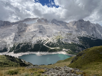
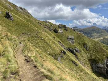
Once you reach the dirt road, the climb toward Porta Vescovo really gets going. In the final stretch, the gradient becomes quite steep, but the trail surface remains excellent, allowing you to maintain good rideability. The effort is more than rewarded once you reach the summit: from Porta Vescovo, the view is simply magnificent, with a 360° panorama that takes in the Marmolada, the Sella, and the great peaks of the Dolomites. It’s time to change gears. From here, the Alpin Bike section begins on the trail toward the Passo Padon Mountain Hut. The first segment is an uphill traverse followed by the crest and a long descent. The difficulty generally ranges from S1 to S2, with some S3 sections and brief exposed stretches on the right. Caution and safe riding are therefore essential, but when the terrain allows, the trail offers excellent flow. The second part, however, takes on a more trial-like character: small rocks and technical sections require greater precision in line choice, although it’s almost always possible to find the most rideable route (S2).
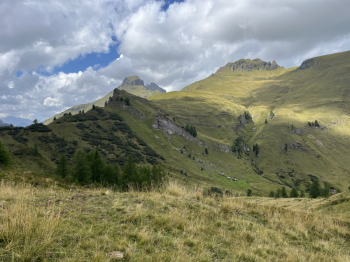
After a couple of short climbs that must be tackled by pushing the bike, you finally reach Padon. The trail then continues along Route 636 to the Bech de Agnarence pass. The surface remains smooth, but the exposure on the right demands the utmost caution. There is also a short uphill section over rocky outcrops that must be tackled by pushing the bike. Once past the pass, the descent into the Davedin valley begins. The first section crosses the mountain pastures on a singletrack with variable terrain, including dirt, grass, and loose rocks. Further on, the terrain becomes predominantly dirt, and the difficulty level is around S2. Upon reaching the Passo delle Crepe Rosse, stay on Trail 636. It is possible to take Trail 635 to the left, but it is not ideal for cycling due to the rather rutted surface.
Continue along the ridgeline, surrounded by a distinctly alpine landscape, until you take a trail on the left that starts out grassy but then turns into a mule track heading toward the Tabià down in the valley, where you rejoin Trail 635. The next forest road follows the valley, and the trail surface improves significantly as you approach Malga Laste. And this is where one of the highlights of the route comes into play. You’ll need to leave the main trail to take an unmarked singletrack: it’s essential to follow the GPS track. A splendid (though unfortunately short) freeride section begins, with an initial steep drop that quickly gives way to a simply spectacular grassy trail. The curves, shaped by the natural contours of the terrain, let you play with your bike and offer a truly satisfying flow. You then return to the dirt road, pass the Migon Mountain Hut, and take the trail on the right toward Ronc. From here, another old trail leads the descent toward the Agordina Valley. The stretch up to Col de Pioge is particularly picturesque, running at the foot of the rock face below Pian de Fesura.
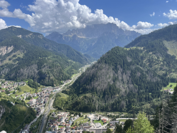
Keep to the right, following a singletrack that soon widens into a broader trail. A short climb precedes the arrival in Rocca Pietore. From here, the route continues along a series of old trails leading first to Saviner and then to Caprile. The final kilometers offer a decidedly more relaxed finish: take the beautiful bike path along the Cordevole River, with its striking view of the majestic Civetta, which follows the course of the valley all the way to Alleghe, where this long and spectacular traverse comes to an end. A comprehensive and highly varied route that packs the full range of Dolomite mountain biking into a single day: major climbs, flow trails, technical sections, alpine biking, freeride, and—above all—views you’ll never forget.