HOME RANKINGS CHALLENGES ROUTES NEAR ME PLANNING SEARCH LOGIN
Italy - Trentino-Alto Adige/Südtirol, TN
2026/07/19 15:16:23

Rifugio Dorigoni, sentiero 103 e laghi Sternai

8 Downloads
0
 
Share
Author
alexghost
(2)
Place
Italy - Trentino-Alto Adige/Südtirol, TN
Km
28,56 km
Elapsed time
08:43:17
Vertical meters
+1 650 mt (1420 - 2831)
Route difficulty
Landscapes
Last update
2026/09/03 23:42:58
Comments
1
Description

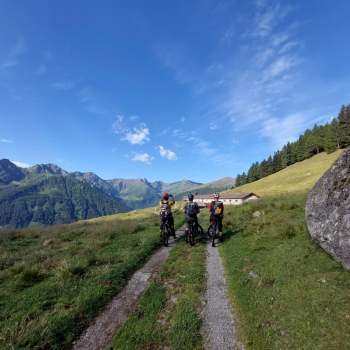
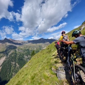
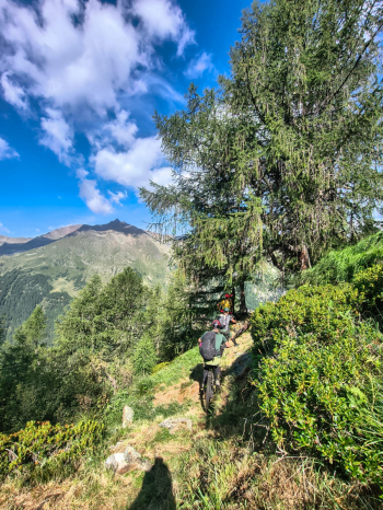
A grand mountain biking tour in the Val di Rabbi along Trail 130, which is absolutely spectacular—a trail that’s exposed in places with a few sections where you have to push your bike, suitable for very experienced riders on e-bikes (from Terzolasa to Dorigoni, about 2.5 hours). Not quite satisfied, we climbed up to the Sternai Lakes; the trail is very steep and requires a lot of pushing, but the reward is immense, and the effort is well worth it thanks to the spectacular, unspoiled setting. Then lunch at the Dorigoni mountain hut and a spectacular descent through the Val del Saent with waterfalls everywhere. Be sure to give hikers the right of way, then, once you reach the Stablasolo alp, more trails and a dirt climb toward the Cavalar parking lot. An incredible ride.
Download our free mobile app to send this route to your Garmin device or to navigate it on OSM maps. Android - iOS
Local weather
Tue 00:00
2 °C
Tue 12:00
8 °C
Wed 00:00
3 °C
Wed 12:00
7 °C
Thu 00:00
6 °C
Thu 12:00
7 °C
Fri 00:00
6 °C
Fri 12:00
7 °C
Sat 00:00
3 °C
Sat 12:00
2 °C

Graph

Nearest Routes

2024/09/14
- Italy - Trentino-Alto Adige/Südtirol, TN
Staff
(110)
25,18 km
Km
+1 404 mt
Vertical meters
Route difficulty
Landscapes
2024/09/14
- Italy - Trentino-Alto Adige/Südtirol, TN
Staff
(110)
30,51 km
Km
+1 046 mt
Vertical meters
Route difficulty
Landscapes
2024/09/14
- Italy - Trentino-Alto Adige/Südtirol, TN
Staff
(110)
22,04 km
Km
+1 064 mt
Vertical meters
Route difficulty
Landscapes
2024/09/14
- Italy - Trentino-Alto Adige/Südtirol, TN
Staff
(110)
18,55 km
Km
+562 mt
Vertical meters
Route difficulty
Landscapes
2024/09/14
- Italy - Trentino-Alto Adige/Südtirol, TN
Staff
(110)
3,18 km
Km
0 mt
Vertical meters
Route difficulty
Landscapes
2025/09/09
- Italy - Trentino-Alto Adige/Südtirol, TN
26,56 km
Km
+1 700 mt
Vertical meters
Route difficulty
Landscapes
2024/09/14
- Italy - Trentino-Alto Adige/Südtirol, TN
Staff
(110)
11,72 km
Km
+11 mt
Vertical meters
Route difficulty
Landscapes
2024/09/14
- Italy - Trentino-Alto Adige/Südtirol, TN
Staff
(110)
12,00 km
Km
+11 mt
Vertical meters
Route difficulty
Landscapes
2024/09/14
- Italy - Trentino-Alto Adige/Südtirol, TN
Staff
(110)
29,33 km
Km
+617 mt
Vertical meters
Route difficulty
Landscapes
2024/09/14
- Italy - Trentino-Alto Adige/Südtirol, TN
Staff
(110)
66,22 km
Km
+2 400 mt
Vertical meters
Route difficulty
Landscapes

1 Comments