Italiano
 Deutsch
Il Cavalbianco e i sentieri del Cupra

This stunning and challenging loop route combines the true spirit of all-mountain riding with the discovery of an impeccably managed trail area. The route stands out for its total respect for the surrounding natural environment, thanks to the work of the Cupra team, who maintain the trails by creating very natural routes without disrupting the landscape.
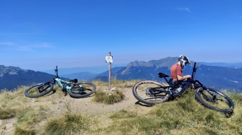
The route officially begins in Ospitaletto, from where you initially climb on paved road toward Passo Pradarena. Before reaching the pass, you leave the paved road to take the trail leading toward the summit of Cavalbianco. The first section winds through the woods: it’s steep but fortunately rideable. Once you’ve left the wooded area behind, the steep slopes and rough terrain force you to carry your bike on your shoulder and continue until you reach the panoramic summit.
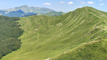
From the summit of Cavalbianco, you’re rewarded with a beautiful descent through the picturesque Vallone dei Mirtilli, which leads back to the main trail. From here, you’ll take the first part of the Cavallegra descent, a trail characterized by a nice, flowing surface skillfully mixed with more technical sections over rocks and roots. Although the natural continuation of the descent would be the Rio Freddy trail, the route includes a detour: you’ll climb briefly along a forest road to join the Gulo Gulo trail, a longer alternative with characteristics similar to the Cavallegra.
Once you reach the road below, the climb back up toward Passo Pradarena begins again. At an elevation of about 1,200 meters, near a fountain, you turn onto the final section of the Pradaletto trail, rejoining the forest road further on that leads to the pass. At an elevation of 1,500 meters, you leave the forest road behind for good to follow CAI Trail 639, which leads to Passo della Comunella, joining the spectacular ridge trail. Continuing to climb along the ridge to an elevation of about 1,700 meters, take the trail toward Monte Sillano. However, instead of climbing to the summit, proceed in the opposite direction to reach the start of the Supernatural descent. This trail is followed only partially and abandoned as soon as you cross CAI 639 again.
At the sign for the Rio Re Mountain Hut, continue along the former Trail 637, which, unfortunately, is in a state of disrepair. You follow only a portion of it until you cross the current route of trail 637, then veer off again onto an unmarked trail that passes directly beneath the summit of Il Monte. After this rugged traverse, you’ll find yourself on CAI trail 641. At an elevation of 1,470 meters, the final and most adrenaline-pumping part of the route begins: take the Z-Line UP trail to reach the ridge and launch yourself into its downhill section. This seamlessly combines with the Sergio Line (upper and lower sections), creating an endless trail that’s mostly flowy but peppered with technical sections requiring excellent riding skills.
The very long descent ends in Ligonchio. From here, to complete the loop, all that’s left is to tackle the final road climb back to Ospitaletto.
Logistical Tip: To avoid ending the ride with a grueling final climb from Ligonchio to Ospitaletto, it’s best to park directly at the Ligonchio sports field. This way, you’ll tackle the climb to Ospitaletto at the start of the ride with fresh legs.