Italiano
 Deutsch
Capoliveri Legend Cup, Buca del Bandito, Portoferraio

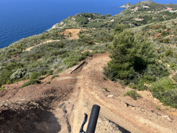
The best of the Capoliveri Legend Cup (CLC): the legendary descent of the Buca del Brigante and the return to Portoferraio. The route starts in Capoliveri and climbs up to Monte Calamita, following the CLC trail (a tough climb on a forest road). Then a first flowing descent takes us back to the forest road that runs along Monte Calamita to Ripe Alte. Keep left and follow it for a stretch; at Palazzo Calamita, climb up a forest road to take a first short trail—flowing but technical—that descends to the path running along the sea. Here, descend to the mine, and after a short climb, descend to the beautiful Cannello beach.
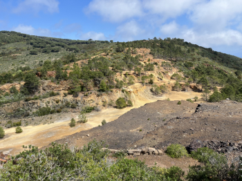
Climb back up the forest road and return to Palazzo Calamita. Take the previous forest road again, and this time take a beautiful, scenic, and rideable single track that climbs to the upper forest road, leading toward Poggio Polveraio—the premier trail area of the CLC: steep sections, technical passages over dirt and rock, and flowing stretches. After a couple of laps, follow a single track that climbs again (tough but rideable sections) and takes you toward Ripe Alte. Here begins a series of coastal passages (some of which can even be skipped), which offer spectacular views. The descent to Remaiolo Beach (dirt road) is also worth it. Then continue the loop along the Gabbiani coast, climb back up to Poggio Turco, and then take the spectacular switchback descent toward the Ginevro mine.
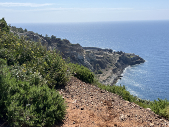
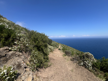
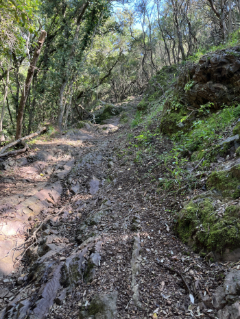
Climb up the forest road to Ripe Alte and then descend again along the coast, following the spectacular trail above Capo Calvo, Punta Nera, Punta Calanova, and finally Punta Perla, with the single track leading from Forte Focardo to Narengo. From here, follow the paved road out of Mola and arrive just before Porto Azzurro, where you’ll take a steep climb toward Monte Castello. A section on a steep, uneven rocky mule track will require technique and strong legs, then the trail becomes more rideable. After Monte Castello, a steep climb (rideable) and a final push uphill before reaching the start of the Buca del Brigante (below Cima del Monte).
After a technical start with sections over small rocks, the single track turns into a fun flow ride. In the central section, a series of compressions and breathtaking climbs, more challenging technical sections, narrow passages, and more steep sections and rocky terrain. A short sprint, and then the final flow section, unfortunately slowed down by a couple of fallen trees. You reach the asphalt and arrive in Portoferraio.
Medium difficulty S3, S4-S5 in some sections #elba