Italiano
 Deutsch
Col des Combes

A full-on all-mountain ride with a descent offering views of the Gruyères landscape, which can be completed in 2-3 hours.
Most of the climb is exposed to northeast: especially in the final part, the snow tends to persist for a long time, with a good chance of still finding it in early summer. The mountain pastures along the route are only used from mid-summer onwards and the fountains are activated at the same time; it is therefore advisable to set off with a good supply of water and refill at the fountains in the Vallée du Motélon.
Departure
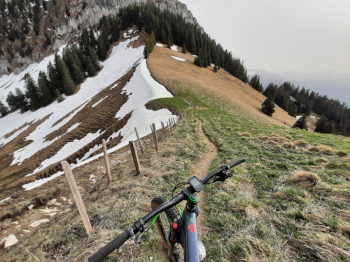
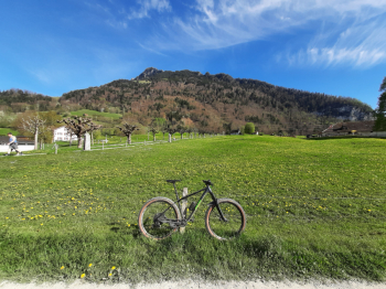
The tour starts from the Broc Sports Center, where you can park for free, or, for those arriving by public transport, from the Broc-Chocolaterie station. Follow a secondary paved road with little traffic and a regular gradient, which climbs gently to the entrance of the Vallée du Motélon. Continue through the valley to the junction at an altitude of 1001 m: up to this point, the gradients remain below 10%. After passing a barrier that closes the road to motorized traffic, the real climb begins, immersed in a picturesque landscape of mountain pastures. The asphalt continues to the Groins-du-Milieu alp (1348 meters). From here, the road alternates between dirt tracks and short cemented or asphalted sections to Groins-Dessus (1462 meters), where the trail to Col des Combes begins. This section is often damp and can be muddy, making it difficult to cycle in places; however, in good conditions, it is possible to remain in the saddle until about 1630 m. The last section before the pass inevitably requires pushing/carrying the bike.
Descent
Once you reach Col des Combes (1668 meters), the trail immediately starts on the opposite side. The first half of the descent takes place in an open environment among meadows up to about 1300 meters. This section has steep gradients and a crumbly limestone surface, which increases braking distances: difficulty S3. Entering the woods, the trail widens and the gradients become more regular, although there are loose stones. It is not uncommon to find fallen logs on the trail: please be careful. The trail is also used by hikers heading to Dent de Broc: difficulty S2. Once you reach Le Chalet (754 meters), take the paved road that leads to the river; from here, continue on the dirt road, enjoying the last few kilometers of the tour, which will take you comfortably back to the starting point.