
 Italiano
 Deutsch
2025/11/16 17:37:51
Giro dei 5 rifugi da Villabassa
Author

Place
Italy - Trentino-Alto Adige/Südtirol, BZ
Km
80,64 km
Elapsed time
05:23:33
Vertical meters
+2 200 mt (1119 - 2165)
Route difficulty
Landscapes
Last update
2025/11/18 09:35:15
Comments
Hotels
Description
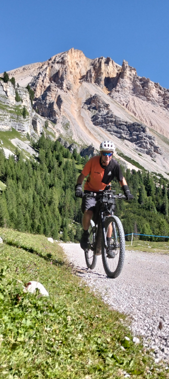
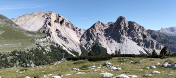
Rather long and challenging itinerary, though devoid of technical difficulties. The views are nothing short of stunning. Possibly you can start from Cimabanche pass.
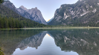
From Villabassa you get to Cimabanche on a bike path, from there you climb with beautiful ramps to the splendid Forcella Lerosa pass.
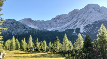
You descend to Ra Stua, climb to the Sennes hut via a very steep and long ramp, descend to Pederù with a very steep descent.
Go up again to the Fanes hut and Limo pass and descend to the St. Hubert bend, with a final climb.
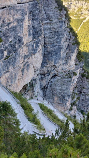
From here you reconnect with the bike path to Dobbiaco, climb to Cimabanche and then final descent to the starting point.
Tour also doable in reverse. but preferably by ebike because very steep.
Local weather
Thu 00:00

16 °C
Thu 12:00

24 °C
Fri 00:00

18 °C
Fri 12:00

22 °C
Sat 00:00
17 °C
Sat 12:00
23 °C
Graph
Nearest Routes
51,40 km
Km
+1 210 mt
Vertical meters
Route difficulty
Landscapes
2023/03/05
- Italy - Trentino-Alto Adige/Südtirol, BZ 118,42 km
Km
+1 920 mt
Vertical meters
Route difficulty
Landscapes
2023/02/26
- Italy - Trentino-Alto Adige/Südtirol, BZ 34,09 km
Km
+1 420 mt
Vertical meters
Route difficulty
Landscapes
48,18 km
Km
+1 684 mt
Vertical meters
Route difficulty
Landscapes
48,18 km
Km
+1 500 mt
Vertical meters
Route difficulty
Landscapes
33,21 km
Km
+750 mt
Vertical meters
Route difficulty
Landscapes
2023/03/05
- Italy - Trentino-Alto Adige/Südtirol, BZ 46,65 km
Km
+450 mt
Vertical meters
Route difficulty
Landscapes
34,64 km
Km
+1 320 mt
Vertical meters
Route difficulty
Landscapes
28,95 km
Km
+1 110 mt
Vertical meters
Route difficulty
Landscapes
55,01 km
Km
+1 450 mt
Vertical meters
Route difficulty
Landscapes