Italiano
 Deutsch
Val Ferret e 3 rifugi

Loop tour in Val Ferret that touches the Refuges Elena, Bonatti and Bertone on single trails constantly facing the Mont Blanc Massif.
Refuge Elena elevation 2,066 m, open from mid-June to mid-September. Rif. Bonatti elevation 2,025 m, open from mid-May to early October. Rif. Bertone elevation 2,000 m, open from early June to late September. I would avoid the mtb tour in July and August and perhaps weekends until mid-September. The trail connecting the refuges is shared with hikers who are normally given priority.
The route is divided into five sections: ascent to Rif. Elena completely cyclable; descent to Arpnouva with some technical passages at the 'beginning and end of the section; ascent from Arpnouva with a first section that is not very cyclable; traverse to Rif. Bonatti and then above Rif. Bertone cyclable; descent to Planpincieux cyclable.
The 'loop starts from one of the hamlets of Courmayeur, Planpincieux, 1,590 m, and we join the valley floor road following it to Lavachey (1,640 m) and then to the hamlet of Arpnouva (1.790 m) near which, shortly afterwards, the asphalt road ends and the most challenging stretch of ascent begins in terms of gradients and bottom (dirt road) in the direction of the Elena Refuge (2,066 m), which can be reached in about half an hour of easy pedaling.
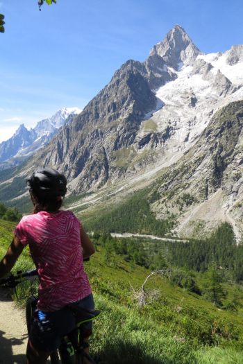
From the refuge, where there is a remarkable panoramic view of the entire Val Ferret and the glacier of Pré de Bard, an excellent and evident path starts that descends to the bottom of the valley and is for the most part rideable without any particular difficulty, except for a few steep passages easier on the grassy slope in the last part and a few tight bends on a slippery surface in the first part.
It then retraces in common with the outward route a few hundred meters on the road to deviate, near the wooden bridge, onto the TMB (Tour du Mont Blanc) trail near some houses in the hamlet of Arpnouva and then begins to climb in altitude on the slope of Mont de Belle Combe: the first 100 meters of altitude are in fact cyclable for rare and brief moments due to the trail being too steep between bushes and pines; then two traverses with lesser gradients allow you to quickly gain meters until you arrive, always alternating with pushing stretches, at the Arpnouva alpine pasture of mezzo (2005 m).
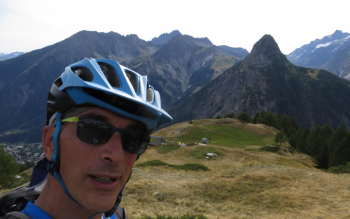
Here the trail becomes more regular and rideable with continuous ups and downs in an environment devoid of vegetation until the Bonatti Refuge (2,025) where there is a wonderful natural balcony on the Mont Blanc massif and in particular on the Grandes Jorasses, someone glimpses the Boccalatte Refuge. From the Bonatti Refuge, always following the TMB, you lose altitude slightly and continue on single trail in the direction of the Bertone Refuge; within a little more than an hour of pedaling you reach a panoramic summit (2,040 m).
For the descent to the valley either opt for the TMB trail to Courmayeur or for the easier descent back to Leuchey to rejoin the Val Ferret road and return to the parking lot.
The Hiker Publisher No. 1 - Mont Blanc - Courmayeur - Trail map (1:25,000)