Italiano
 Deutsch
San Cerbone, Cielo Alto e Guendalone

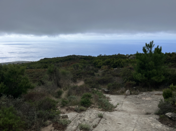
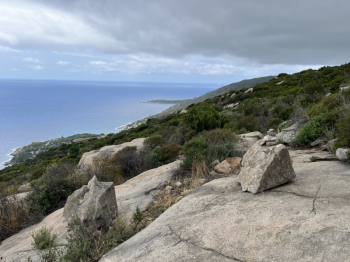
Long and rewarding hike in the central western part of the island of #elba with three beautiful descents. Start from Colle d'Orano and climb to Marciana by asphalt road and then take the forest road to San Cerbone. Before taking the path down to S.Cerbone take the path on the right that goes up to connect to the GTE. This section is a technical but well rideable (99%) climb. At the intersection with the GTE take a left and a spectacular and very scenic section begins, in the first part slightly uphill on granite slabs and in the second part slightly downhill with flowing sections and more technical sections on firm rock and some climbing (98% rideability). You come to the road that climbs from Poggio to Monte Perone and take a right. Once at the top of the hill, short descent and then right to climb on trail to the S.Piero pistini (fallen trees on the trail have been removed). When you reach the section with the pistini towards Poggio, take the hard climb to the right towards Masso ala Quata.
At Masso alla Quata the legendary Cielo Alto descent begins, which then continues as Masso alla Guata to Cavoli. For me it is among the most beautiful trails on the island: technical sections bordering on trialistic, steps, passages on rock and firm stone, canyons, flow sections, a real bike park. Some short dirt-bottomed sections have been a bit hollowed out by recent downpours, but rideability is 99 percent. When you get to Cavoli, take a left and by asphalt you get to Marina di Campo (variant on trail in the final part). You proceed by bike paths and pass the campsite and then to the right take the hard forest road up to Monte Tambone, very technical but 99% rideable.
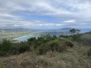
Once over the top turn right and take the nice single track that goes down to Laconella (with the final variant that goes up for a short distance and take the final little pistino that is nice and technical). On asphalt you proceed in the direction of Lacona by internal roads passing the church of S.Maria and then climb up the beautiful track among the olive groves under Colle delle Vacche that takes us to cross the ridge GTE (hard climb at times, but all rideable). Left on the GTE for the quiet forest road to the crossroads of S.Martino. Here keep right and shortly after left to take the third descent: the Guendalone.
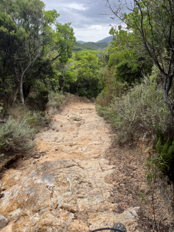
This is a little-known trail, but one that deserves it; the first section flows on single track with a few raises and then the final section is decidedly trialistic on rock and boulders that must be ridden very carefully.On the asphalt right in the direction of Colle di Procchio and then a short descent to Procchio. Here on asphalt to Marciana Marina and at a junction take a left to Redinoce. Climb on asphalt and then take the forest road that leads to Poggio and from there to Marciana. Here take the single track from the Cemetery that descends to Marciana and continues after the asphalt road. At the fork turn left for Cai 8 to Masciarello, S.Andrea Zanca. and then the nice scenic single track to Patresi and by asphalt the last few meters to Colle d'Orano.