Italiano
 Deutsch
Elba Ovest

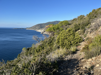
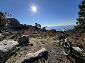
Tour in the western part of Elba. Depart from Colle d'Orano and by asphalt to Chiessi, scenic trail between Chiessi and Pomonte and then asphalt again to Colle Palombaia. Here take a right and follow the nice scenic trail to Marina di Campo (traverse, big climb and drop to Colle Turato, traverse, short push climb and then a nice flow section to Marina).Here by bike path and trails you reach via dei Forchioni where the climb to colle Reciso begins, which continues to S.Ilario all on forest road. Asphalt and climb to Monte Perone, but at the forest road to S.Piero take a left and then a right to climb to Masso ala Quata (nice steep final toboggan) .
Here begins the spectacular descent of Masso ala Quata (for me the most beautiful of the Island) both as views and as variety of track; very technical, trialistic sections on rock, steps, steeps, flowing sections and following track and indications you get to Cavoli and by trail to Seccheto. Here I wanted to try a new ascent to return to S.Piero but it is not cyclable so I recommend to follow the asphalt unless you love adventure and 1km of pushing bike is not a problem (the trail has several rock steps to climb and in the first section is quite overgrown by vegetation, maybe in better conditions the cyclability could increase, currently it does not exceed 5-10%).
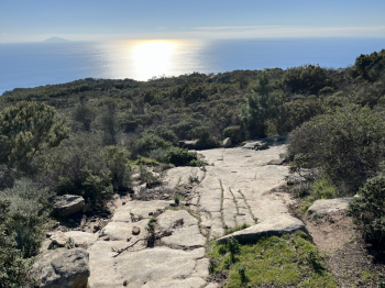
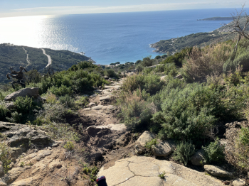
One connects for a short stretch to the path made downhill and then follows the path to S.Piero. One takes to S.Ilario and this time climbs to Monte Perone by the beautiful and at times steep forest road (all cyclable). Off the hill one descends by asphalt to Poggio and then to Marciana. Past the village at a sharp left bend one takes a downhill path to the right and after a short rocky stretch to the left.The trail in the first section is a nice flow (at this time a bit ravaged by wild boars) coming to a crossroads and keeping left you proceed to S.Andrea. Technical section on rock and steps and then flow again. You get to Masciarello, then Cottoncello, S.Andrea, climb back up to Zanca and then the traverse to Patresi and by asphalt shortly you get to Colle d'Orano.