Italiano
 Deutsch
Pic de Caramantran e tanti laghi
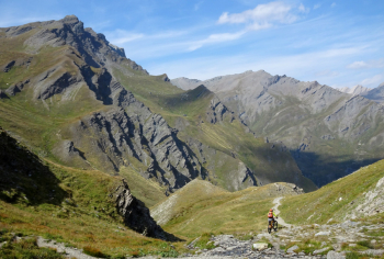
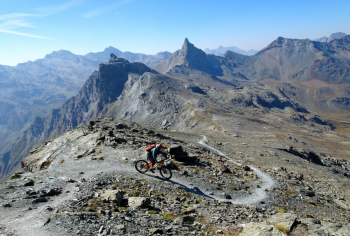
The start of this "light" cyclo-mountaineering hike is from a convenient parking lot just outside Chianale in Val Varaita. We climb after about 9 km and 970 meters of elevation gain to Colle dell'Agnello on asphalt with gradients around 10%. From Colle dell'Agnello we will no longer see asphalt but only singletrack. We start downhill until we intercept the path that by pushing or by bike on the shoulder climbs to Col de Chamoussière. Still up and we are on the summit of Pic de Caramantran at 3021 meters from which there is a splendid view of the surrounding peaks (Monviso, Rocca Bianca, Roc della Niera).
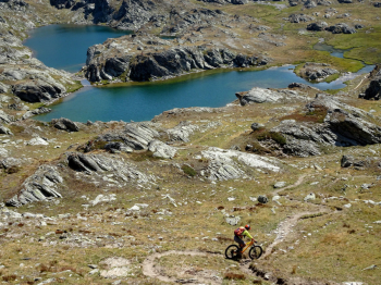
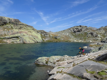
Now descent where flowing sections alternate with short technical sections until we pass the Col de Saint Verain where we lose altitude on the French side until we skirt Lac Blanchet Superieur and Lac Blanchet Inferieur. From Lac Blanchet Inferieur a path starts that with a push bike takes us to Col Blanchet. Now flow descent to Lac de la Roc della Niera practically dry where we have to reach the path on the right ridge that does not lose altitude (not very cyclable with bike sections but it is short). By staying high we manage to see at the same time both the Blue Lake that we will reach later and the Black Lake.
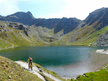
The trail becomes cyclable again near an esplanade where the Bes Lakes, Lac Longet from which the Ubaye originates and other smaller lakes are embedded. We retrace our steps to Col Longet where a difficult descent begins and ends on the trail we left earlier. We skirt and pass the Blue Lake with the trail that is no longer flowing but starts to get technical with some really difficult passages. We continue to descend until we find the car again in the parking lot of Chianale.
Spectacular hike for views and panoramas capable of satisfying bikers who have no problems with a backpacking bike and who possess good downhill technique (prevailing difficulty S2-S3 and short sections S4). Also pay attention to hikers present especially in the last section from Blue Lake to the car. Please refer to the report for more information.