HOME RANKINGS CHALLENGES ROUTES NEAR ME PLANNING SEARCH LOGIN
Italy - Trentino-Alto Adige/Südtirol, BZ
2025/08/12 09:11:06

Sulle tracce di Otzi - Similaun - Val Senales

43 Downloads
5
 
Share
Author
steve-U
(26)
Place
Italy - Trentino-Alto Adige/Südtirol, BZ
Km
43,72 km
Elapsed time
11:50:27
Vertical meters
+2 550 mt (1694 - 3025)
Route difficulty
Landscapes
Last update
2025/08/17 20:19:22
Comments
2
Description

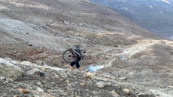
A challenging but spectacular loop between Italy and Austria. We start from Lake Vernago, the heart of Val Senales, with the bike loaded with enthusiasm and desire for adventure. The first ascent is a very steep forest road: I'll tell you right now that we shouldered the MTB, I'm not kidding! If you prefer to save your energy, you can take the cable car up to the Giogo Alto glacier and from there go down a very technical trail to the pass (as of August 2025, the cost is about 22 Euros for the ascent + 4 Euros for the bike).


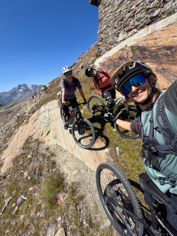
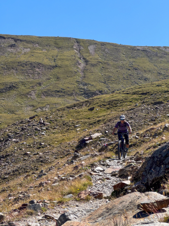
Once at the Border Pass, a seemingly never-ending traverse begins, leading all the way to Vent, Austria. The trail is challenging: some sections are tackled by pushing, bikeable for a good 90% but still for experienced riders. Before reaching Vent you encounter some of the overhanging points over the creek, where there is a steel lanyard for support, but the trail remains quite wide.


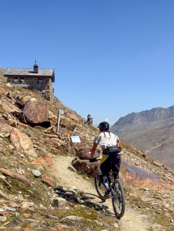
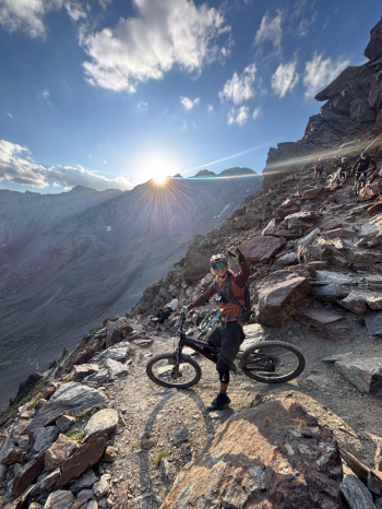
From Vent the real challenge begins: a very long forest road that leads to the "Martin Busch Hut." From here starts an equally long trail, about 3/4 of it rideable by E-bike and about 1/4 of the first section rideable by classic bike. This trail leads to the Similaun Hut, from where the descent begins.

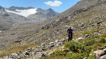
The descent begins with a kilometer of very technical trail (S4/S5) with exposed sections: I strongly recommend pushing the bike for safety. Then the trail becomes a technical trail (S3/S4), with gradually decreasing gradient, very fun but reserved for experienced riders with good alpine technique.

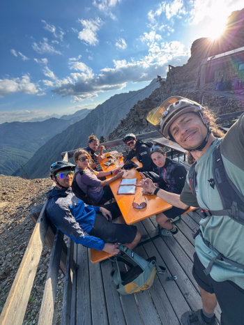
In summary, this is a photonic, strenuous and rewarding ride, combining spectacular views, fun and the satisfaction of having taken on a true high mountain adventure.

?

Download our free mobile app to send this route to your Garmin device or to navigate it on OSM maps. Android - iOS
Local weather
°C
°C
°C
°C
°C
°C
°C
°C
°C
°C

Graph

Nearest Routes

2022/08/22
- Italy - Trentino-Alto Adige/Südtirol, BZ
nonnocarb
(294)
30,40 km
Km
+1 865 mt
Vertical meters
Route difficulty
Landscapes
2023/03/04
- Italy - Trentino-Alto Adige/Südtirol, BZ
nonnocarb
(294)
28,35 km
Km
+1 500 mt
Vertical meters
Route difficulty
Landscapes
2024/10/24
- Italy - Trentino-Alto Adige/Südtirol, BZ
Staff
(99)
19,65 km
Km
+1 700 mt
Vertical meters
Route difficulty
Landscapes
2024/09/04
- Italy - Trentino-Alto Adige/Südtirol, BZ
nonnocarb
(294)
31,33 km
Km
+1 500 mt
Vertical meters
Route difficulty
Landscapes
2024/08/12
- Italy - Trentino-Alto Adige/Südtirol, BZ
steve-U
(26)
35,58 km
Km
+1 292 mt
Vertical meters
Route difficulty
Landscapes
2024/10/29
- Italy - Trentino-Alto Adige/Südtirol, BZ
nonnocarb
(294)
35,52 km
Km
+1 400 mt
Vertical meters
Route difficulty
Landscapes
2024/01/05
- Italy - Trentino-Alto Adige/Südtirol, BZ
nonnocarb
(294)
18,66 km
Km
+1 050 mt
Vertical meters
Route difficulty
Landscapes
2023/03/04
- Italy - Trentino-Alto Adige/Südtirol, BZ
nonnocarb
(294)
26,12 km
Km
+1 250 mt
Vertical meters
Route difficulty
Landscapes
2023/03/07
- Italy - Trentino-Alto Adige/Südtirol, BZ
nonnocarb
(294)
51,34 km
Km
+980 mt
Vertical meters
Route difficulty
Landscapes
2022/10/30
- Italy - Trentino-Alto Adige/Südtirol, BZ
nonnocarb
(294)
72,93 km
Km
+2 970 mt
Vertical meters
Route difficulty
Landscapes

2 Comments