Italiano
 Deutsch
Le Tre Cime: Galliner, Terre Fredde, Frerone
Cycloalpine tour par excellence, with much "Habsburg" portage and little pedaling, in the southernmost part of the Adamello massif. Two superb descents in grandiose surroundings with garden-like blooms and sweeping views from the Pre-Alps to the Adamello glaciers.
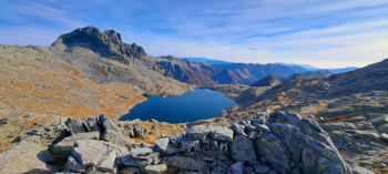
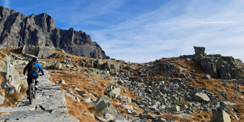
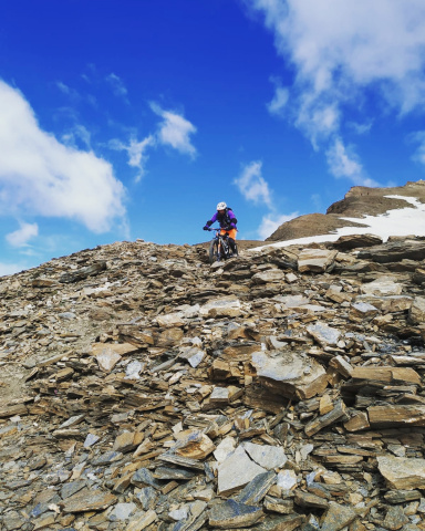
Starting at malga Cadino, climb to Lake della Vacca, pedaling (with muscle bike) to Corna Bianca. Continuing from the Tita Secchi refuge in the direction of the Blumone pass, to the junction where the track begins, which, passing through the Laione pass, leads to the Galliner peak (bike mostly on shoulder) at 2576. meters. After a very short descent, climb to the nearby Terre Fredde peak, 2645 meters.
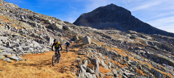
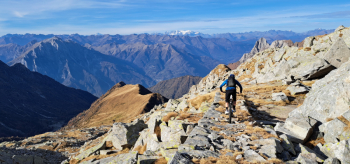
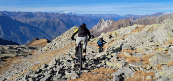
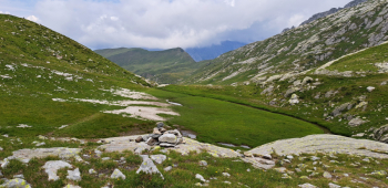
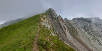
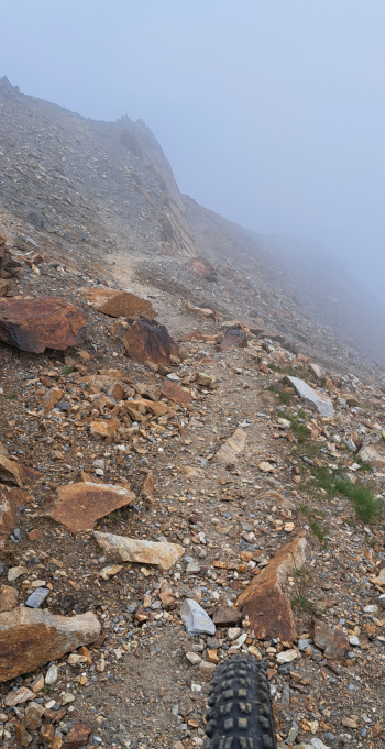
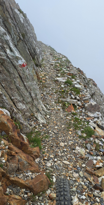
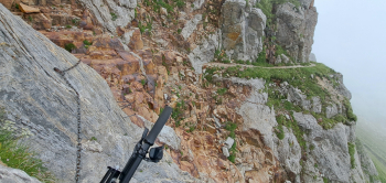
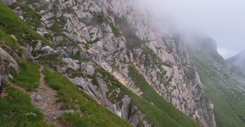
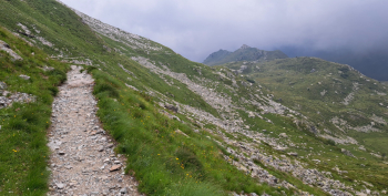
First superb descent (S2-S3) to the idyllic Gheza refuge at Foppe di Braone, along what remains of the old Great War military mule track. The environment is wild, open, typical of the Adamellitic glacial valleys. The upper Braone Valley is a veritable paradise with its broad marshy grasslands the steep rocky granite flanks. With effort pushing and especially carrying the bike you reach Frerone Pass, 2444 meters. From the pass, following the sharp ridge, by steep trail (CAUTION) you reach the top of Frerone, 2673 meters. Second descent beautiful tough at times very exposed with a section of equipped ledge, to be approached with great caution (S3-S4). Reaching Passo Vafredda the descent becomes quieter (S2) but still fun. From Passo dell'Asino, passing by malga Casinetto dei Dossi you return to malga Cadino (S2-S3 until the malga then S1-S2).
THIS TOUR IS RESERVED FOR EXPERIENCED MOUNTAIN BIKERS WHO DO NOT MIND LITTLE PEDALING. THERE ARE EXPOSED TRACKS AND technical descents (difficulty S2 to S4). NO EBIKE.