
 Italiano
 Deutsch
Anello dei Tre Signori

If you’re looking for the ultimate ride—one that rightfully belongs in the “Top 5” of the Bergamo area—you’ve found it. Pizzo dei Tre Signori isn’t for everyone: 2,300 meters of total elevation gain, with a full 1,300 meters spread over 7–10 km of brutal portage. It’s a mystical experience that will take you to the roof of the Orobie Alps, where granite and exertion merge into an indelible memory.
Ascent
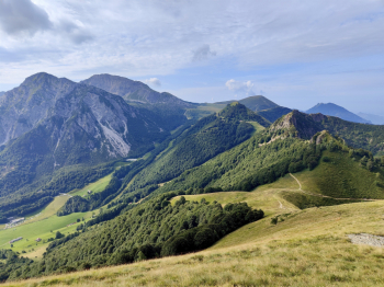
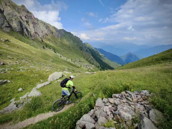
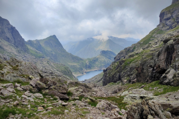
We start from Valtorta. The first section serves to warm up the muscles: an asphalt climb with consistently manageable gradients leads us to the Piani di Bobbio, a natural amphitheater of rare beauty. From here, we continue toward the Passo di Gandazzo on a very pleasant “eat and drink” trail.
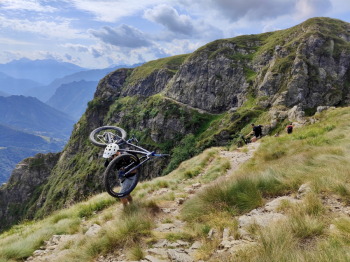
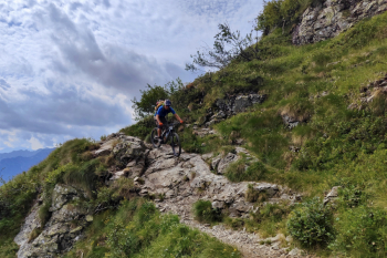
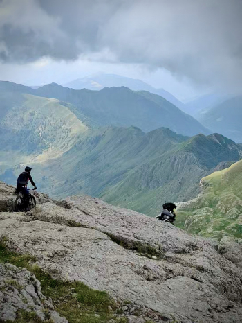
But it’s at the pass that the easy part ends: the bike goes on your shoulders, and the real ascent toward Passo del Toro begins. A technical traverse (S4) follows to Passo di Foppabona, where you’ll once again shoulder your bike with determination to reach Rifugio Grassi. After a refreshing break, a beautiful traverse (S1 with sections of S3) takes us to Bocchetta di Castel Reino.

The Cardinal’s Trail and the summit
We turn onto the Sentiero del Cardinale: here we proceed almost entirely on foot. Technical tip: on the initial stretch, stomp your feet firmly to make noise; the area is known for the presence of vipers.
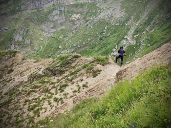
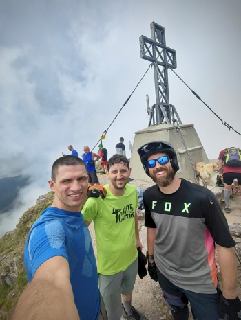
From Bocchetta di Piazzocco, the final ascent to the summit begins. With bikes on our shoulders, we climb while carefully studying the lines: what you’re climbing now, you’ll soon be descending. The last 100 meters are on loose terrain, while the final 15 meters feature a couple of chains to aid passage (nothing too difficult). At 2,550 meters, at the summit of Pizzo dei Tre Signori, the 360° panorama is simply breathtaking.
Descent
With protective gear on, it’s time to switch things up.
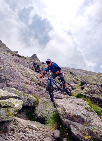
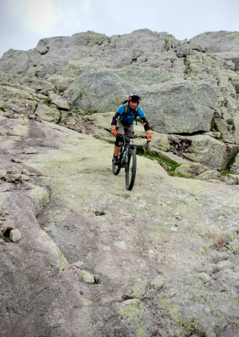
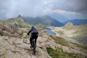
- The Megaroccione: Once past the first 30 meters from the summit, the descent becomes stratospheric. The surface is a single, immense slab of super-grippy granite that allows for endless route options (S3/S4). A rare treat at high altitude.
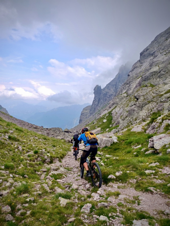
- Toward the FALC: From Bocchetta di Piazzocco, descend toward the Falc Hut over technical scree (S3/S4), skirting Lago dell'Inferno.
- The Inferno Valley: After the final 200m of carrying gear to Passo dell'Inferno, a relentless descent begins. A constant technical S3/S4 section all the way to Baita Ciarelli.
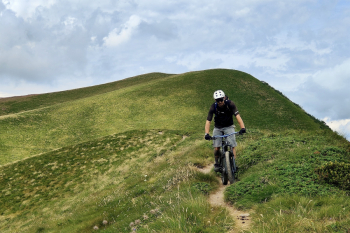
- The Finale: From the hut, the route takes the “toughest” path (S3/S4), avoiding the easier eastern variant. It concludes with a short climb on a cart track, a final S2 trail, and the return on asphalt to Valtorta.
Notes: We considered shortening the route by taking the Caminetto trail instead of the Cardinale trail, but the videos online don’t look promising.
Trail style: All-mountain
Personal rating: Views 10/10; Descents 9/10
MTB: Yes
EMTB: Not recommended
Duration: approx. 11h (by MTB)
Portage: 1300m
Ascent difficulty: Easy
Descent difficulty: Moderate S3/S4
Exposure: Short, standard exposures typical of mountain trails, but nothing that cannot be avoided by descending or keeping a safe distance from the edge
Draining: YES
Water sources: See description


