
 Italiano
 Deutsch
Anello dei Tre Signori

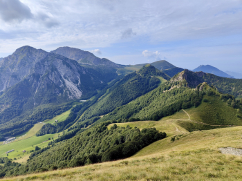
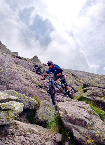
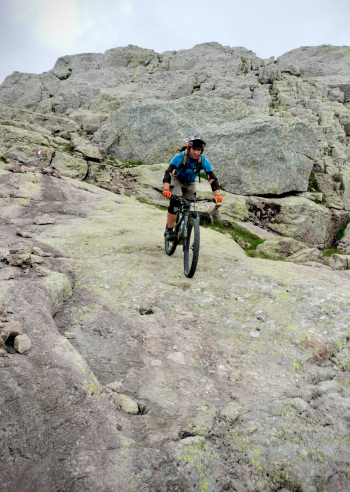
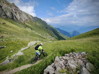
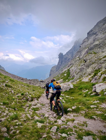
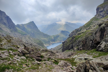
Epic cycle-mountaineering tour par excellence, to be put among the top 5 of the Bergamasque. 2300 meters of elevation gain and 32 km, of which 1300 meters and 7/10km with the bike on your back. Start from Val Torta, climb with always manageable gradients on asphalt to the Bobbio plains, a very beautiful plateau nestled among the mountains. We continue to the Grandazzo pass from nice eat-and-drink trail. From the pass we climb with bike on shoulder on trail to the Toro pass and to follow on nice traverse with several S4 passages to the Foppabona pass, we put the bike on shoulder again to climb to the Grassi refuge. After a short and well-deserved break we continue on beautiful traverse S1 with some short S3 sections, (if desired rideable) to the Castel Reino pass.

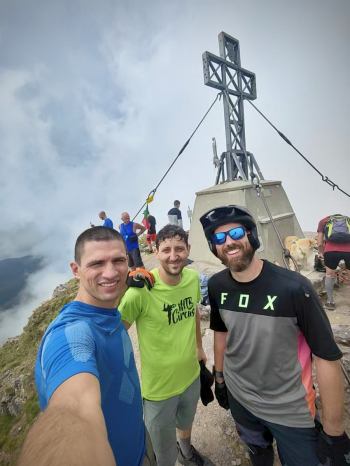
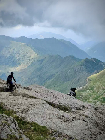
We deviate onto the Cardinal trail with various eats and drinks almost all on foot to the Piazzocco vent. In the initial section you may encounter some adder, so I recommend stepping well on your feet to make noise. From Bocchetta di Piazzicco, still with bikes on our backs, we ride the trail up to Cima dei Tre Signori, looking at the best lines where we can descend next. The last 100 meters are on a friable path but are nevertheless well traveled, while in the 15 meters there are a couple of chains to facilitate the ascent (nothing complicated). Arriving at the top of Pizzo dei Tre Signori at 2550 meters the view is exaggerated and 360°.
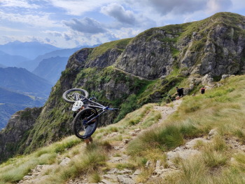
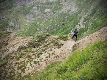
Protections on we descend from the ascent path, where past the first 30 meters the descent becomes stratospheric and unique, in fact the bottom is almost all a supergrippy granite megaroccione, which offers numerous lines of interpretation (difficulty S3/S4).
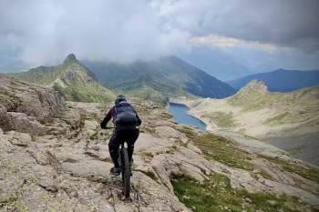
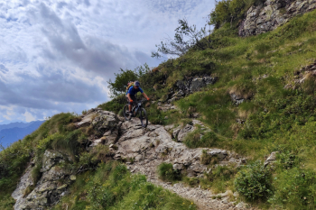
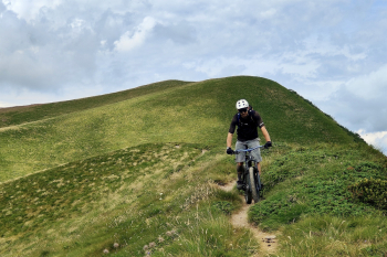
From Bocchetta di Piazzocco the trail descends to the Falc hut on sfaciume with several S3 and S4 passages. We continue skirting Inferno Lake for the last 200 meters of backcountry biking to Inferno Pass. From the pass, the trail into the Inferno valley is an S3/S4 descent that gives almost no respite until Baita Ciarelli. From the hut it is possible to descend from the easier trail to the east or continue from the trail from the more challenging trail than the previous one with many S3 and S4 passages.We finally continue on carrale with a short ascent and then deviate from trail S2 and last 100 meters on asphalt to the starting point.
Notes: We considered shortening the ride by going via the Caminetto trail instead of the Cardinal trail but the videos online do not look promising.
Trail Style: All mountain
Personal rating: Views 10/10; Descents 9/10
MTB: Yes
EMTB: Not recommended
Duration about 11h (by mtb)
Portage: 1300m
Difficulty ascent: Easy
Difficulty descent: Average S3/S4
Exposed: Short and normal exposures for mountain trails, but nothing not avoidable by descending or passing at the proper distance from the edge
Drainage: YES
Water points: See description
