Italiano
 Deutsch
Masso Ala Quata - Bollero

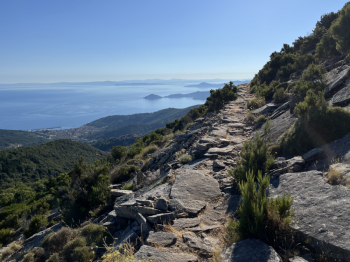
Hike in the western part of the island of #elba. Start from Colle d'Orano and go up to Marciana by asphalt road and then take the forest path to San Cerbone. Before taking the path down to S.Cerbone take the path on the right that goes up to connect to the GTE. This section is a technical but well rideable (99%) climb. At the intersection with the GTE take a left where a spectacular and very scenic section begins, in the first part slightly uphill on granite slabs and in the second part slightly downhill with flowing sections and more technical sections on firm rock and some climbing (98% rideability). You come to the road that climbs from Poggio to Monte Perone and take a right. Once at the top of the hill, short descent and then right to go up on trail to the San Piero pistini (here a couple of fallen trees on the trail create a bit of difficulty, though surmountable).
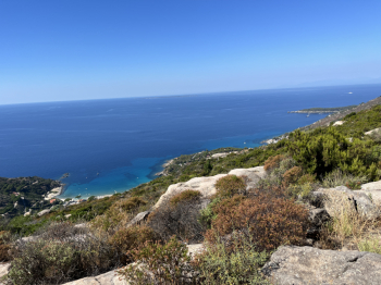
Arriving in the section with the pistini towards Poggio, take the Tozzi Carletto pistino which is a nice flow, but with a few jumps and more technical passages. At the forestry right to climb back to the start of the pistini and now turn left for the hard climb to Masso ala Quata. At Masso alla Quata begins the legendary descent of Cielo Alto which then continues as Masso alla Guata to Cavoli. For me it is among the most beautiful trails on the island; technical sections bordering on trialistic, steps passages on rock and firm stone, canyons, flow sections, a real bike park; rideability is 99%.
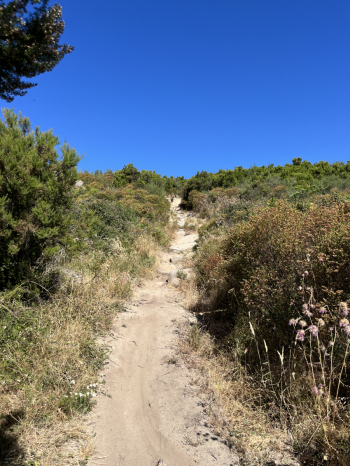
When you get to Cavoli, left and at a sharp right bend take a trail that climbs to the left. Steep but rideable section and past a house at a fork, keep left. The trail becomes a sigle track uphill, technical but 99% rideable until it drops into the forest road that leads to San Piero.From San Piero by asphalt to San Ilario and here by the forest road next to the sports field to Colle Reciso. Here on the left short descent and then uphill to Poggio. Back to Marciana by asphalt, take the Via Crucis to Madonna del monte (last hard climb) and then by the nice traverse to Serraventosa. Descent to Bollero (flow but with steps and firm boulders) and then right to Bollero. First section with steep dirt and firm boulders, technical. Then steps and technical passages alternating with flow sections.Keep right, and follow the old trail (mule tracks with firm boulders and steps/grades). Short ascent past the creek and then flowing but still technical descent to the Patresi bridge and from here left shortly to Colle d'Orano.