
 Italiano
 Deutsch
2025/06/07 09:26:36
Zugna - Passo Buole - sentiero 117
Author

Place
Italy - Trentino-Alto Adige/Südtirol, TN
Km
45,29 km
Elapsed time
04:30:41
Vertical meters
+1 850 mt (235 - 1771)
Route difficulty
Landscapes
Last update
2025/06/07 09:32:32
Comments
Description
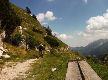
Unfortunately, the central part is on provincial road even if not busy.
- Departure from St. Mary's church to the north and signs for sanctuary and war memorial bell.
- At the first fork after the first hairpin bend to the right signposted for war memorial shrine and dinosaur footprints
- We follow the paved road signposted artillerymen's road and then at a left hairpin bend take the dirt road to dinosaur footprints
- First left fork to Albaredo and follow the dirt road to the next paved road
- Right on asphalt until its end
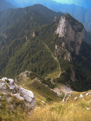
- Follow the dirt road that comes off at the end of the asphalt to the top of Mount Zugna from which there is a stupendous view that in this case I did not reach but once you get to the Austro-Hungarian park in 5 minutes you are at the cross
- We now follow signs 115 that take us to Passo Buole with stupendous views now of the Terragnolo valley, now of the Adige valley.
- At Passo Buole we take trail marker 117.
- Arrived at the village Cuneghi on asphalt road towards Riva di Vallarsa and here on provincial road towards Albaredo.
- We follow the provinciale now north to the village of Albaredo, for those without gps at this point I recommend the descent on provinciale to Rovereto, for those who can follow the track a short climb and then on numerous paths we return to the starting point.
Local weather
Stasera

17 °C
Domani

25 °C
Domani sera

12 °C
sabato

27 °C
Sabato notte

14 °C
domenica

28 °C


Graph
Nearest Routes
39,39 km
Km
+1 950 mt
Vertical meters
Route difficulty
Landscapes
59,43 km
Km
+2 200 mt
Vertical meters
Route difficulty
Landscapes
22,31 km
Km
+1 100 mt
Vertical meters
Route difficulty
Landscapes
30,58 km
Km
+1 250 mt
Vertical meters
Route difficulty
Landscapes
51,67 km
Km
+2 500 mt
Vertical meters
Route difficulty
Landscapes
51,46 km
Km
+1 900 mt
Vertical meters
Route difficulty
Landscapes
2023/03/02
- Italy - Trentino-Alto Adige/Südtirol, TN 31,15 km
Km
+1 470 mt
Vertical meters
Route difficulty
Landscapes
2023/05/19
- Italy - Trentino-Alto Adige/Südtirol, TN 37,21 km
Km
+1 900 mt
Vertical meters
Route difficulty
Landscapes
2025/06/07
- Italy - Trentino-Alto Adige/Südtirol, TN 46,43 km
Km
+2 050 mt
Vertical meters
Route difficulty
Landscapes
37,02 km
Km
+1 000 mt
Vertical meters
Route difficulty
Landscapes