
 Italiano
 Deutsch
Monte Alben (versione cicloalpinistica)

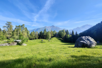
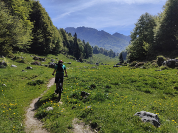
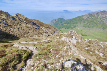
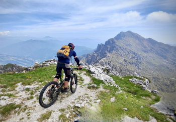
In this Cycloalpine version we go to on the spectacular trails of Mount Alben. Start from Cornalba, we continue towards Serina and Valpiana on asphalt, then we deviate on gravel road with 80 meters quite steep in places, continue to Pian della Palla and to follow on path not always rideable (in mtb) until the path that descends from Passo del Sappli. Bike on the shoulder and in 150 meters we are at the Pass from which we will continue on beautiful, mostly rideable trail to the Alben Refuge.
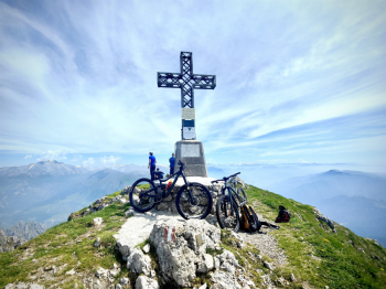
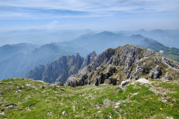
Again Bike on the shoulder and in 450m we climb to the summit of Mount Alben, from which we can admire the 360° panorama
To descend we retrace the same path as the ascent. This is a beautiful S4 trail with a few S5 passages and no particular exposures.
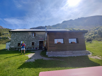
Definitely avoid thinking of doing the high ridge from the Brassamonti Pass to the Alben (it is all on the shoulder with narrow and ultra-uncomfortable passages). (Optional) From the refuge if we still have some we can climb 250 meters with the bike on the shoulder to the gallows (Brassamonti Pass). The trail is less uncomfortable than the one going up to Alben and by emtb we ride a few sections. We leave the bike at the pass and and continue on foot for about 150 meters to the summit of Cima della Croce (the trail has downhill rideability practically close to zero). We then descend to the Alben hut from nice trail S3. We then descend by technical descent S4 to Cornalba
Ascent variants
By emtb it is more comfortable to climb from Cornalba by this trail.
In mtb climb from Serina this track.
Descent variants
Easy descent S2 from Sappli pass this track.
Technical descent S4 from Sappli pass this track.
Trail style: all mountain
Personal Rating: Panoramas 9/10; Descents 9/10
MTB: Yes
EMTB: Not recommended because of the long portage
Duration about 7h (by mtb)
Portage: +1000m
Difficulty ascent: at times challenging in mtb
Difficulty descent: Almost all S3/S4
Exposed: a few sections
Draining: YES
Water points: Alben Refuge
Full video of the descent from the summit


