HOME RANKINGS CHALLENGES ROUTES NEAR ME PLANNING SEARCH LOGIN
Italy - Lombardia, BG
2025/03/17 21:47:08

Anello Gioco + Pizzo Rabbioso, Discesa Val Cumina (versione media)

9 Downloads
0
 
Share

Key Takeaways / Scheda Tecnica

Disciplina:
Mountain Bike (MTB)
Percorso:
Anello Gioco + Pizzo Rabbioso, Discesa Val Cumina (versione media)
Località:
Italy - Lombardia, BG
Distanza:
25,25 km
Dislivello Positivo:
+1 268 mt (Quota Min: 347m - Max: 1204m)
Difficoltà Tecnica:
4/5
Valutazione Panorami:
4/5
Formato Traccia:
GPX Download disponibile
Author
ValeBG
(181)
Place
Italy - Lombardia, BG
Km
25,25 km
Elapsed time
09:32:25
Vertical meters
+1 268 mt (347 - 1204)
Route difficulty
Landscapes
Last update
2025/03/18 08:52:23
Comments
0
Description

Ring medium difficulty less challenging than this tour that passes under the mountain game and Game to Rabbioso wanting you can mix. All mountain in Val Brembana, two peaks for a very challenging ride. Start from San Pellegrino we climb on Emtb rideable trail (in mtb follow this climb) and we break the climb deviating to the beautiful traverse of Salvarizza. Challenging but doable also in mtb.
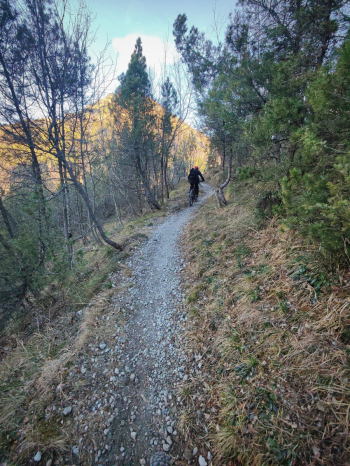
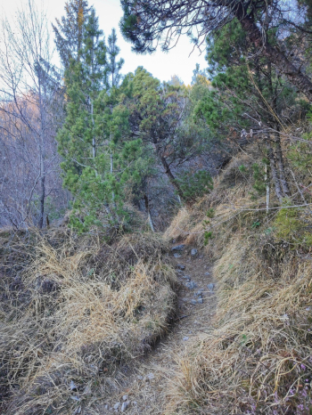
Foto itinerario MTB Anello Gioco + Pizzo Rabbioso, Discesa Val Cumina (versione media) - Italy - Lombardia, BGFoto itinerario MTB Anello Gioco + Pizzo Rabbioso, Discesa Val Cumina (versione media) - Italy - Lombardia, BG

We rejoin the asphalt this time to climb toward Mt. Game. but instead of getting to the cross we deviate to the south trail, thus reducing the push/shoulder section to only 100 meters, we continue bypassing the mountain on a trail that is not always rideable due to its narrow width and expesiion (not extreme but not to be overlooked either). From the junction below Mt. Zucchin it becomes a very scenic S2/S3 that has difficult only the several switchbacks and a few passages toward the end of the descent.

Immagine che contiene aria aperta, natura, montagna, cielo

Il contenuto generato dall'IA potrebbe non essere corretto.Immagine che contiene aria aperta, bicicletta, montagna, cielo

Il contenuto generato dall'IA potrebbe non essere corretto.Immagine che contiene aria aperta, cielo, natura, camminata

Il contenuto generato dall'IA potrebbe non essere corretto.

Arriving in Lepreno by deviating north there is a fountain. We continue following the track then deviate to a nice trail that with a short eat and drink comes out on the "pipe trail" a beautiful all guided S1 traverse, slightly exposed to the left.
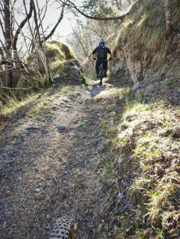
Foto itinerario MTB Anello Gioco + Pizzo Rabbioso, Discesa Val Cumina (versione media) - Italy - Lombardia, BG

At Frerola we follow to Pradai and find ourselves on a very challenging climb (15% with gravel bottom, white so reflecting the sun).

.Foto itinerario MTB Anello Gioco + Pizzo Rabbioso, Discesa Val Cumina (versione media) - Italy - Lombardia, BGFoto itinerario MTB Anello Gioco + Pizzo Rabbioso, Discesa Val Cumina (versione media) - Italy - Lombardia, BG
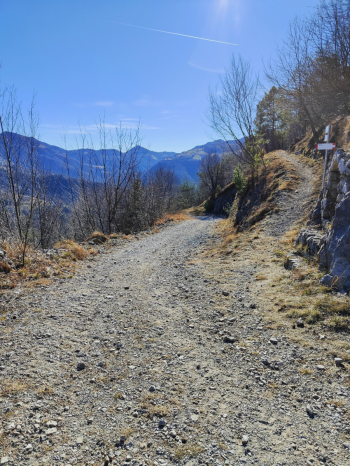
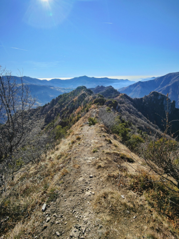
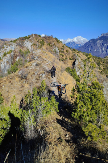
From the summit of Pizzo Rabbioso we admire the beautiful ridge that we will have to walk to reach the other cross, in 5 minutes we walk beautiful the ridge, an exposed S5 trail to be done practically all by pushing.
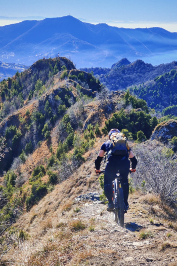
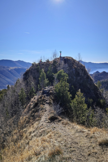
Foto itinerario MTB Anello Gioco + Pizzo Rabbioso, Discesa Val Cumina (versione media) - Italy - Lombardia, BGFoto itinerario MTB Anello Gioco + Pizzo Rabbioso, Discesa Val Cumina (versione media) - Italy - Lombardia, BGFoto itinerario MTB Anello Gioco + Pizzo Rabbioso, Discesa Val Cumina (versione media) - Italy - Lombardia, BG

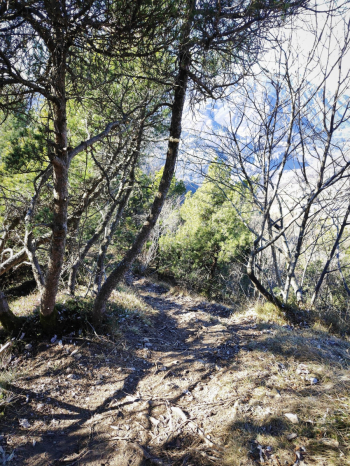
For those who do not like exposed I recommend this trail.
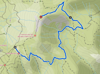
Foto itinerario MTB Anello Gioco + Pizzo Rabbioso, Discesa Val Cumina (versione media) - Italy - Lombardia, BG

From the second cross of Pizzo Rabbioso a beautiful S4/S3 descent begins.
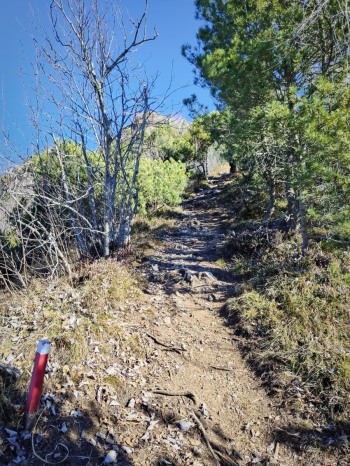
Foto itinerario MTB Anello Gioco + Pizzo Rabbioso, Discesa Val Cumina (versione media) - Italy - Lombardia, BGFoto itinerario MTB Anello Gioco + Pizzo Rabbioso, Discesa Val Cumina (versione media) - Italy - Lombardia, BG

We continue following the trail on S2 trails and finally onto the beautiful Val cumina, a spectacular, technical trail just right.

Trail style: AM

Personal rating: 8/10

MTB: yes

EMTB: yes eyes to some pushing sections

Duration about 6h (by mtb)

Portage: yes

Difficulty ascent: challenging

Difficulty descent: medium S3/S4 with various S1/S2 links

Drainage: ND

Download our free mobile app to send this route to your Garmin device or to navigate it on OSM maps. Android - iOS
Local weather
Mar 00:00
12 °C
Mar 12:00
16 °C
Mer 00:00
14 °C
Mer 12:00
17 °C
Gio 00:00
13 °C
Gio 12:00
15 °C
Ven 00:00
7 °C
Ven 12:00
13 °C
Sab 00:00
10 °C
Sab 12:00
12 °C

Graph

Nearest Routes

32,39 km
Km
+1 448 mt
Vertical meters
Route difficulty
Landscapes
2025/03/17
- Italy - Lombardia, BG
ValeBG
(181)
29,47 km
Km
+1 350 mt
Vertical meters
Route difficulty
Landscapes
2025/03/16
- Italy - Lombardia, BG
ValeBG
(181)
27,67 km
Km
+1 150 mt
Vertical meters
Route difficulty
Landscapes
2025/12/22
- Italy - Lombardia, BG
albeoi
(1)
23,89 km
Km
+1 250 mt
Vertical meters
Route difficulty
Landscapes
2023/03/11
- Italy - Lombardia, BG
ValeBG
(181)
37,16 km
Km
+1 850 mt
Vertical meters
Route difficulty
Landscapes
2022/10/16
- Italy - Lombardia, BG
ValeBG
(181)
24,38 km
Km
+1 300 mt
Vertical meters
Route difficulty
Landscapes
2023/02/18
- Italy - Lombardia, BG
ValeBG
(181)
26,50 km
Km
+1 450 mt
Vertical meters
Route difficulty
Landscapes
2024/02/17
- Italy - Lombardia, BG
ValeBG
(181)
16,90 km
Km
+1 000 mt
Vertical meters
Route difficulty
Landscapes
2024/02/08
- Italy - Lombardia, BG
ValeBG
(181)
21,61 km
Km
+1 200 mt
Vertical meters
Route difficulty
Landscapes
2022/11/02
- Italy - Lombardia, BG
ValeBG
(181)
20,56 km
Km
+1 150 mt
Vertical meters
Route difficulty
Landscapes

0 Comments