Italiano
 Deutsch
Monte Borla da Tenerano

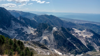
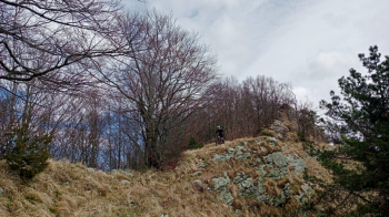
Mount Borla is among the few Apuan peaks that lends itself to being ridden entirely on a mountain bike. Although the ridge section is not very long, it is nonetheless very scenic, and on clear days, in addition to the Versilliese and Ligurian coasts, the nearby Gorgona and Capraia, even the island of Elba and Corsica can be glimpsed.
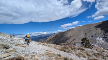
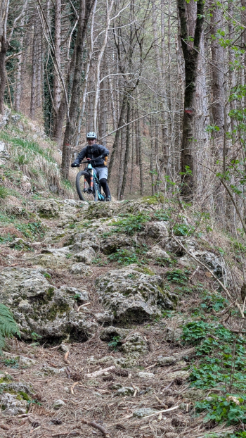
We depart from the small village cemetery and via asphalt we reach the provincial road coming from Carrara, which we leave immediately after a few dozen meters, turning left and following the sign for Campocecina. The climb is never steep and in some sections very scenic over the coast and the marble quarries. When we arrive at the large piazzale dell'Uccelliera we take a restorative break before tackling the last part of the climb with stretches of back-cycling that will take us to the summit of Borla. We resume pedaling to the mouth of Pianza where we take Cai 173 in beautiful view of Sagro Mountains, Pizzo d'Uccello and Pisanino, and as long as the trail allows us we stay in the saddle and then switch to the shoulder portion.
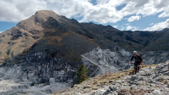
After the rocky section we can once again resume pedaling, at least until the junction where we abandon 173 in favor of the trail leading to the summit. The stretch is short and shortly thereafter we arrive at the Martignoni House also known as the Borla hut located just below the summit at an altitude of 1460 where we leave our bikes to go and take the usual summit photo. Before leaving we let ourselves be immortalized by the Web Cam placed on the Hut then we straddle the bikes and begin the descent to the Campocecina meadows.
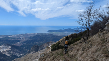
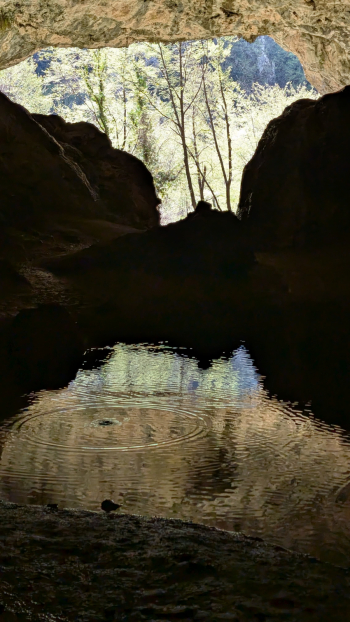
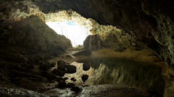
The ridge descent does not have excessive complications except being very careful because it is very exposed in some sections. Arriving below the Zucco del Latte we point to the meadows and bypassing Mount Ballerino we arrive at the Carrara refuge where we take a second break. At the restart we head towards the Piazzale di Acquasparta where we take the Cai 185 called Tunnel because of the presence on the end just before arriving at Gabellaccia of a large natural stone arch. At the pass we continue our descent by taking Cai 197 with the hope that it will be clean and entirely cyclable.
The trail does not disappoint us, it runs fast without complications and surprisingly put quite well, it has no difficulty but remains pleasant until the Bardinello stream that we have to ford. Having crossed the latter we have to climb a short distance to get to the starting point,but first given the proximity of Tecchia di Tenerano we decide to pay it a visit, because according to a friend it is worth seeing.