HOME RANKINGS CHALLENGES ROUTES NEAR ME PLANNING SEARCH LOGIN
Italy - Emilia-Romagna, BO
2025/01/27 18:45:32

West Side Trail

1 Downloads
1
 
Share
Place
Italy - Emilia-Romagna, BO
Km
31,61 km
Elapsed time
05:12:47
Vertical meters
+1 850 mt (725 - 1694)
Route difficulty
Landscapes
Last update
2025/01/27 18:53:09
Comments
0
Description

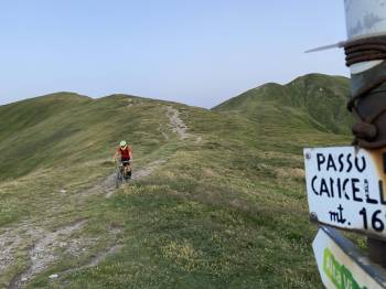
This is definitely a challenging itinerary both from a physical point of view, given the 30 km length and about 1850 meters of elevation gain, and from a technical point of view as we face Fiammineda and Cancellino, two of the most challenging descents in the Area.

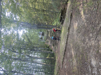
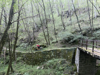
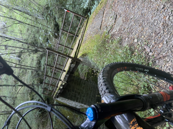
We start from Vidiciatico (815 meters) and follow the asphalt road that leads to Budiara (1194 meters), from here we take the Budiara Ring to the Tese Pass where the first descent begins, Fiammineda, which takes us to Pianaccio (915 meters). We continue on the paved road that takes us to Rifugio Segavecchia (930 meters); from here we continue on the forest road that takes us to Bocca del Lupo. From here we take the trail that leads to the Cancellino Pass passing by the Uccelliera where we take the descent that takes us back to the Segavecchia Refuge; a challenging trail that alternates flow segments with nice tight hairpin bends that will test the skills of the most experienced trialists.

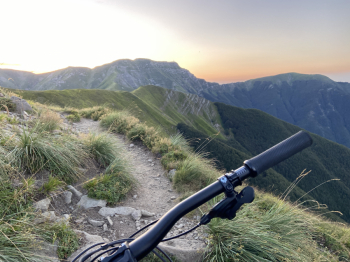
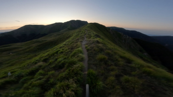
We climb up the forest road called the Calvary that takes us first to Sbocata dei Bagnadori then to Saltiolo (1393 meters) the highest point of the Bike area. From here you can choose one of several descents that take us back to Vidiciatico. This route gives emotions that are hard to forget and views that are absolutely worth seeing.


Download our free mobile app to send this route to your Garmin device or to navigate it on OSM maps. Android - iOS
Local weather
°C
°C
°C
°C
°C
°C
°C
°C
°C
°C

Graph

Nearest Routes

2023/12/31
- Italy - Emilia-Romagna, BO
40,15 km
Km
+1 370 mt
Vertical meters
Route difficulty
Landscapes
2024/06/09
- Italy - Emilia-Romagna, BO
Paoloc1
(69)
30,53 km
Km
+1 700 mt
Vertical meters
Route difficulty
Landscapes
2025/01/25
- Italy - Emilia-Romagna, BO
32,32 km
Km
+1 350 mt
Vertical meters
Route difficulty
Landscapes
32,32 km
Km
+1 340 mt
Vertical meters
Route difficulty
Landscapes
2025/01/25
- Italy - Emilia-Romagna, BO
50,11 km
Km
+2 010 mt
Vertical meters
Route difficulty
Landscapes
2025/01/26
- Italy - Emilia-Romagna, BO
55,02 km
Km
+2 580 mt
Vertical meters
Route difficulty
Landscapes
31,29 km
Km
+1 410 mt
Vertical meters
Route difficulty
Landscapes
2025/01/27
- Italy - Emilia-Romagna, BO
52,92 km
Km
+2 100 mt
Vertical meters
Route difficulty
Landscapes
2023/09/25
- Italy - Emilia-Romagna, BO
Paoloc1
(69)
40,20 km
Km
+2 100 mt
Vertical meters
Route difficulty
Landscapes
2023/07/06
- Italy - Emilia-Romagna, BO
ebsat
(111)
27,77 km
Km
+1 460 mt
Vertical meters
Route difficulty
Landscapes

0 Comments