Italiano
 Deutsch
Fiammineda, Cancellino e Cupolina

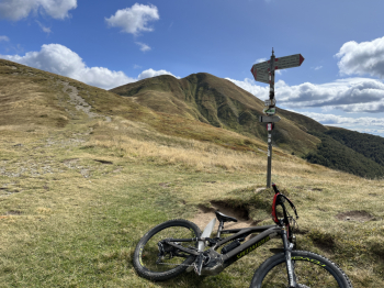
Nice compilation of three descents in the Corno alle scale area. Start at La Ca or Vidiciatico and go up by asphalt to the RioRi bridge, here left for the quiet forestry that goes up to Sboccata dei Bagnadori and then by forestry and trail up to Monte Grande.Here begins a nice descent (not very clean) that is the upper part of Fiammineda; a few (downhill) hand-steps to pass a couple of small rocks, then the rest is well cyclable with fun switchbacks, steeps and a nice trialistic finish on small rocks.Then you take the beautiful descent of Fiammineda which has been cleaned and fixed recently , and is a real sight: hairpin bends, steep technical passages on boulder and rock.
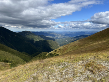
At Pianaccio take a right and climb on asphalt to Segavecchia and then up the long forest road to Portafranca (at Passo del Lupo on the right you go by trail). From Portafranca you pick up and follow the trail that turns south of Poggio delle Ignude and then follow the trail west of the ridge and Monte Gennaio, which is more rideable in the first section than the trail to the east.
Fun single track traverse (with several climbs and descents) with a climb (push) in the final section before reaching Cancellino Pass. Here begins the nice descent back to Segavecchia: smooth at the top and more technical in the lower part.From Segavecchia we go up to Sboccata by forestry and then follow the track, to take the nice and unseen (for us) downhill trail that leads to Vidiciatico. Sliding little pistino at the beginning, then more technical and driven and in the final trialistic part (follow track, as it is poorly marked). We arrive in the upper part of Vidiciatico and by asphalt to La Ca.