Il classico anello del Monte Corchia
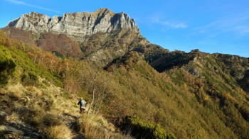
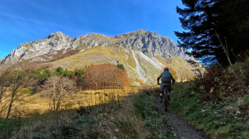
We go up the road to the Croce pass frequented by panchinari, the followers of the giant benches. Here the panorama sweeps over the upper Tyrrhenian and almost all of the Apuan Alps. You pass under the entire west face of Corchia with its beautiful towers and climb up the bumpy marmifera, past the fork to Mosceta, to continue higher until you intercept a shortcut that avoids the first part of the non-bike trail.By fun trail and a few pushes, we ride along the north side of Corchia until we change to the east side, here the most challenging part begins with S4 passages to reach the excellent Del Freo refuge in Mosceta, one of the most alpine in the Apuan Alps. Here we are between two giants, the Corchia and the "queen" Pania della Croce. The Refuge alone would merit the trip excellently run by the friendly Stefano for more than a decade.
We continue by trail to the "Screaming Lair" cave, a few push passages to reach the most other huts of Alpe di Puntato. From here a nice natural flow to reach the small church in the abandoned post-war village of Puntato. We continue by excellent trail to another ghost town, Col di Favilla. One of the day's gems awaits us, the trail down to Holy Island Lake. To be done all in one breath, along the descent you will suddenly see on the left a garish cobalt blue color beyond the vegetation, there it is, you have arrived at the lake. The latter is an icon of the Apuan Alps and a visit to the small village on its shores is recommended.
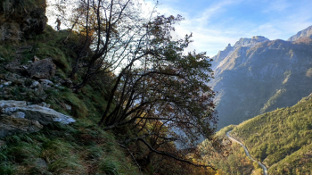
You go up the provincial road without getting bored as on the right you will admire the huge wall of Mount Sumbra with all its articulations and streams with characteristic potholes. Past locality Tre fiumi, you will reach the entrance of the tunnel of Cipollaio that we will avoid by climbing on a steep path to the right. With trained leg or ebike it will be possible to climb it all while remaining in the saddle, you will pass by pools of crystal clear water and then climb through beech forest with hairpin bends to the ridge. Here is another gem of the day, the whole ridge from Colle Cipollaio to the mouth of Fordazzani that coincides with the old Gothic Line. Watch out for exposure and stop to visit one of the many bunkers there. Greatly beautiful route, partly carved into the wall, it is always aerial, so stay with your brain on at all times.
Return to starting point by final little path. Possible to increase the elevation gain by starting further down, from the junction between the provincial road and the road to Croce pass, increasing the total elevation gain by 200 meters.


 Italiano
 Deutsch