Tour dei forti e lac Noir (la Vachette, Val Claree)
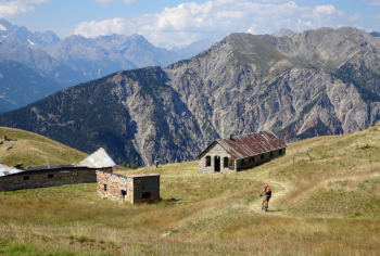
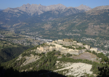
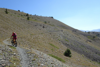
The start of this hike, which guarantees excellent views of the main fortifications in the Briancon area, is from La Vachette (first village in Val Clarée). You will see that the trail presents a first little loop that, in hindsight, is worth doing in reverse to how we hiked it. We pass severalforts, following Route Stratègique de la Cerveyrette, a military road (dirt/old asphalt with zero traffic) that has signs prohibiting passage for motor vehicles. On a curve to the left, a nice traverse starts to the right, a bit exposed but with a wonderful bottom feasible only with absence of snow given the signs of strong avalanche danger.
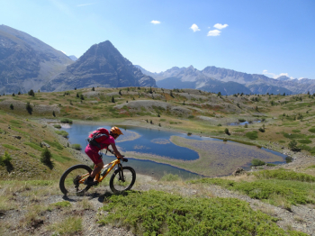
We arrive still on nice single track at Lac Noir, whose color could take on pinkish tones due to the flowers of the aquatic plants. Now short push section after Lac Noir until we cross the ridge, where a fantastic trail with views of the Ecrins Group resumes. We go over the Col du Gondran (EST) on a dirt road , which we immediately leave to climb by pushing/shouldering (short section) to the overhanging Fort Gondran (also the arrival point of several lifts used in the winter period). We are at the highest point of the tour and several signs remind us of the names of adjacent peaks.
Excellent views also of Fort Janus and nearby Chaberton. We descend among a myriad of military structures to Col du Gondran and up to a last group of ruins called La Cochette. Now you can put on protection because a little hidden on the right begins a very traicklong single, never difficult, where fun is assured. Curve after curve we arrive at the point mentioned at the beginning, where we did the first loop that in our opinion is better to do in reverse. We are at the bottom, cross the road and are at the car in La Vachette.
For more photos and detailed description see the photoreport.


 Italiano
 Deutsch