HOME RANKINGS CHALLENGES ROUTES POI PLANNING SEARCH LOGIN
Italy - Trentino-Alto Adige/Südtirol, TN
2024/07/17 10:32:26

Cima Mandriolo

10 Downloads
0
 
Share
Author
Scc
(3)
Place
Italy - Trentino-Alto Adige/Südtirol, TN
Km
39,32 km
Elapsed time
06:37:43
Vertical meters
+1 906 mt (427 - 2017)
Route difficulty
Landscapes
Last update
2024/07/17 14:17:52
Comments
3
Description

Departure from Lochere, parking lot in front of bar/pizzeria, Menador climb on asphalt, then continue left on pleasant dirt road (100km dei Forti) to junction fori Pizzo di Levico.

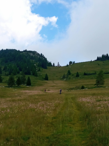
Continue on asphalt road that then turns into dirt road (closed to traffic direction) Malga Porta Manazzo. A little before the malga you turn left to reach Cima Mandriolo, push/pull your bike for about 200 meters of elevation gain. From the summit you descend on the ridge with technical sections to Porta Manazzo.

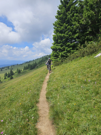
Definitely descend by nice trail with technical S2-S3 sections to the Sella valley. From val di Sella go up 150 meters on forest road to Zoparina locality, From here starts in nice trall flow with some short sections of technical and somewhat exposed steps. From the Novaledo bicigrill you return to Lochere along the bike path.

We diverted the last piece because the trail was infested with brambles.


Download our free mobile app to send this route to your Garmin device or to navigate it on OSM maps. Android - iOS
Local weather
Today
15 °C
Tonight
11 °C
Tomorrow
13 °C
Tomorrow night
12 °C
Sunday
18 °C
Sunday night
11 °C
Monday
18 °C
Monday night
10 °C
Tuesday
17 °C
Tuesday night
10 °C

Graph

Nearest Routes

2024/05/16
- Italy - Veneto, VI
Staff
(75)
21,38 km
Km
+911 mt
Vertical meters
Route difficulty
Landscapes
2023/03/06
- Italy - Trentino-Alto Adige/Südtirol, TN
nonnocarb
(287)
38,71 km
Km
+1 250 mt
Vertical meters
Route difficulty
Landscapes
2023/03/06
- Italy - Trentino-Alto Adige/Südtirol, TN
nonnocarb
(287)
27,93 km
Km
+900 mt
Vertical meters
Route difficulty
Landscapes
2024/05/16
- Italy - Veneto, VI
Staff
(75)
40,69 km
Km
+1 100 mt
Vertical meters
Route difficulty
Landscapes
2023/07/06
- Italy - Trentino-Alto Adige/Südtirol, TN
26,58 km
Km
+600 mt
Vertical meters
Route difficulty
Landscapes
2023/06/24
- Italy - Trentino-Alto Adige/Südtirol, TN
Tommy s.
(3)
7,40 km
Km
+267 mt
Vertical meters
Route difficulty
Landscapes
2023/11/27
- Italy - Trentino-Alto Adige/Südtirol, TN
22,87 km
Km
+1 200 mt
Vertical meters
Route difficulty
Landscapes
2023/09/18
- Italy - Veneto, VI
37,62 km
Km
+1 450 mt
Vertical meters
Route difficulty
Landscapes
2022/08/16
- Italy - Trentino-Alto Adige/Südtirol, TN
gaspa91
(4)
17,79 km
Km
+929 mt
Vertical meters
Route difficulty
Landscapes
2024/02/15
- Italy - Trentino-Alto Adige/Südtirol, TN
21,53 km
Km
+1 150 mt
Vertical meters
Route difficulty
Landscapes

3 Comments