Italiano
 Deutsch
Traversata da Lacona a Colle d'Orano

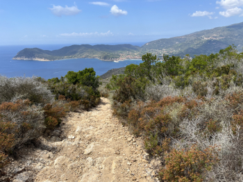
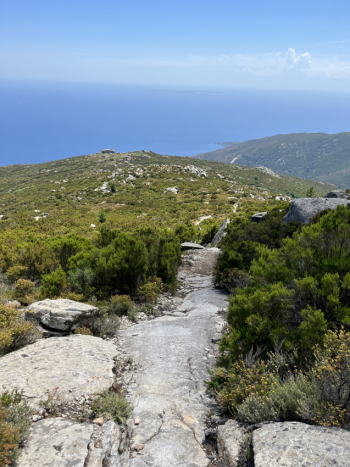
Nice traverse from Lacona to Colle d'Orano, passing the best descents in the area. You take the dirt road from Laconella up to Monte Tambone (hard the first section on loose rock, then more rideable) until you intercept the nice descent down to Lacona and take the nice uphill on trail that reaches Colle delle Vacche and qundi it joins the quiet GTE forest.Near Serra del Pero you take the path to the left that climbs and shortly arrive at the attack of the trail of the same name. Technical descent on firm rock and rock, steps and technical passages, some more flowing sections.
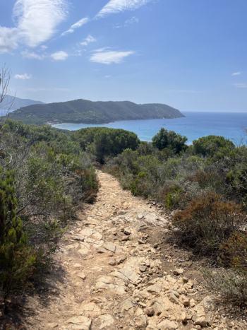
You arrive in Lacona and climb towards the Monumento pass and before the summit you take a forest road to the left that leads to the ridge of Mount Tambone. A few steeper climbs in the final part and you arrive at the descent that descends to Marina di Campo. Very technical trail, trialistic in places on firm rock where it is essential to choose the best trajectory to pass between the outcropping rocks.At Marina di Campo take the forest road that goes up to Colle Reciso and from there to Sant'Ilario. Then to San Piero and then the hard climb to Monte Perone. Past the tower of San Giovanni take the forest road on the left that goes up to Masso Ala Quata (hard the final stretch).
The trail to Masso alla Guata (Cielo Alto) needs no description (it is one of the most beautiful descents on the Island); technical, trialistic, steep, jumps, banks and all doable. Arriving at Cavoli after a short stretch of asphalt you take a forest road to the left that skirts the state highway from above and after a technical descent, arrives at Colle Palombaia. Here you descend by path and small roads to Marina di Campo. You go up again to Colle Reciso and this time take a forest road to the right with some technical passages that with a few ups and downs arrives at Poggio and from here by asphalt to Marciana. From the cemetery you take a descent (small pistino and then rocky) and then follow the signs to S.Andrea, a nice, flowing singletrack in the woods with moderate gradient (only a couple of technical sections on rock and stone). You get to Masciarello and then by trail to Cotoncello. Ascend to Zanca and then by trail (a few ups and downs) you get to Patresi and Colle d'Orano