Periplo del Prana e vetta Piglione sud
Orphan of companions I decide for a ride not far from home on areas that I know well, giving up exploratory ambitions. The choice falls on a nice ride tested by Luca a few weeks ago, where I already have in mind to make some slight changes.I already know that there will be trouble already from the first climb that I know all too well and by which I was baptized years ago by my past Apuane Extreme companions. From the stadium of Camaiore avoiding busy roads and through a nice little path I recover the road that leads to the village of Metato.
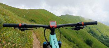
From the small village starts a bristling cemented road of about 2 km that leads to Alpe di Cima that I have already pedaled in its entirety more than once, but today also in consideration of the long ride ahead of me I decide not to persist in doing it all.Contrary to what has been said I manage to pedal almost all the way up, descending only about a hundred meters, and having reached the top I continue on the beautiful traverse under Mount Prana that is practically all pedalable until the Focetta di San Vincenzo.
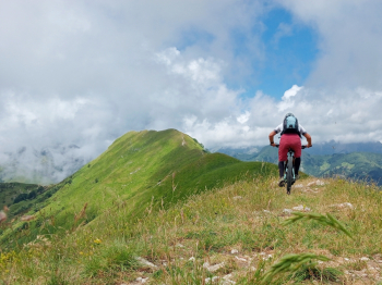
From here I begin a descent that passing by Baita Barsi leads to the village of Ritrogoli, from where I continue on a false level until the houses of Rinchiani turning right onto the road/trail that ends at Parte, from which the normal route to the summit of Mount Piglione starts, where it is necessary in the lower part to load the bike on the shoulders, while once at altitude one can resume pedaling paying attention to the outcropping rocks often hidden among the paleo along the path.Reaching the saddle between the north and south peaks, I continue toward the latter pedaling on the ridge and reaching the Cross placed on the summit. Putting on the protections, a nice almost continuous descent to Convalle awaits me, which joins precisely the Cresta trail to the Indian trail.
Unfortunately, thick fern vegetation has grown up in the lower part, preventing me from seeing the junction where I should have turned, finding myself instead on Cai 103 coming from Groppa. Despite the off-trail warning I decide to continue ahead, having already mentally re-planned the route via a path that rejoins just below the missed junction.This path, too, is literally a fern forest, but by now it is too late to turn around, so amid not a few expletives I continue until I finally find the original trail again.
Arriving on the road, given the unsympathetic out-of-schedule I refresh a little before tackling the second part of the descent to Convalle. The trail is not the cleanest but honestly I expected worse, with two large fallen trees but fortunately easily passed underneath.Reaching the small village I tackle the characteristic staircase and then continue through the narrow streets finding myself on the road that goes up to Passo Lucese. Reaching the latter, I continue downhill on comfortable asphalt until Gombitelli, and soon after with a last effort I reach the beginning of the descent of the Colle that ends in Nocchi.


 Italiano
 Deutsch