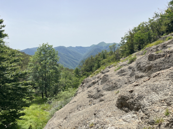
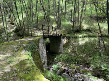
Trail area Corno alle Scale
Beautiful compilation of descents in the new Corno alle Scale bike park, starting in Vidiciatico. You go up to the Budiara via the asphalt road (last section on dirt road). Past the refuge, a couple more steep uphill climbs and then begins the nice trail 127 Speed Of Sound, on the right. A fast trail that alternates very flowing sections with technical passages, steps, natural jumps, parabolics, hairpin bends, ending with a mule track that leads back to the small road that goes up to the Budiara.You repeat the ascent, but before the Budiara you turn left and here you find Axial, a trail with more "technical concentrate," with breathtaking steeps, passages on rocks and steps and some flow sections. You come to the closed road from Lizzano to Vidiciato, take a left and go up to Vidiciato and the Budiara.
Here on the left you pass the bar and climb up the beautiful forest road to a small Corno alle Scale Biker's hut. If you go straight ahead you will quickly reach the Fiammineda trailhead, if you continue left on the forest road, you will climb (last nice steep section) to the top of Monte Pizzo and then with a nice little trail you will descend to the Fiammineda trailhead.This is a beautiful trail with technical/trial passages, more flowing sections, steeps and very driven sections in the woods, up to Fiammineda and then a mule track with a short ascent and you arrive at Pianaccio. Climb up to Rifugio Segavecchia and then the beautiful forest trail, refuge and drop-off at Sboccata dei Bagnadori. Here follow the forest trail that climbs gradually to the Burroni and take 125 (Ca Lenzi, Var Zio) to the left.Another spectacular trail, smoother than the previous ones, but with an intermediate section with very interesting technical passages (in particular a trialistic drop, but with chickenway). Near the asphalt, keep right and after a short ascent another short descent brings us back to the center of Vidiciatico and then to the parking lot.


 Italiano
 Deutsch