
 Italiano
 Deutsch
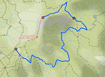
Anello Gioco + Pizzo Rabbioso, discesa su Bracca (versione difficile)

More challenging version of the Gioco + Rabbioso loop. For a softer, less strenuous version see this trail. All mountain in Val Brembana, two peaks for a very challenging ride. Start from San Pellegrino we climb on comfortable asphalt (or offroad by emtb going up from this track) and break the climb by diverting to the beautiful Salvarizza traverse. Challenging but doable also by mtb.
We rejoin the asphalt this time to climb (on the shoulder) to Mt. Game. 300 meters in spectacular surroundings and within about 40-50 minutes we reach the summit.
For Emtb or those who want to reduce the discomfort to 100 meters on the shoulder I recommend following this trail
For those who avoid shouldering completely follow the trail to the north this trail
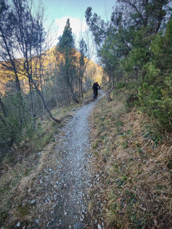
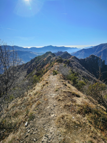
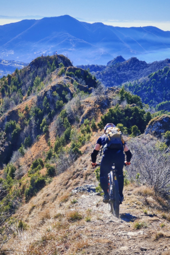
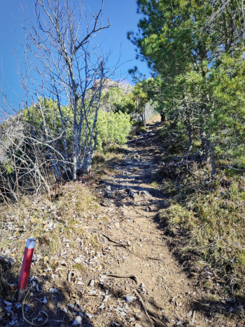
After catching your breath admiring the view the first descent begins, which for the first 150 meters is a very vertical S4.
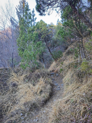
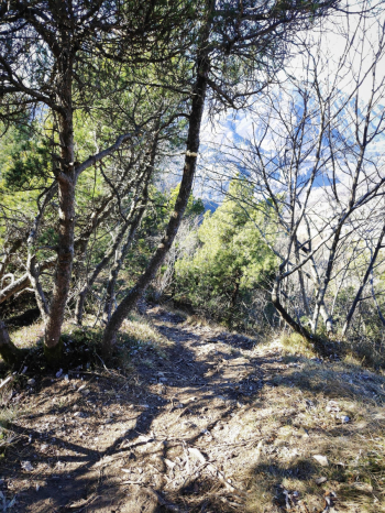
At the junction below Mount Zucchin (Giochino) we continue on the ridge and then descend from a nice surgical S4 trail on a somewhat sduciole bottom. arrived at the junction of the four trails we continue to Lepreno from a nice S2. Wanting to avoid the S4 descent it is possible to descend from the S2 of this trail. Arrived in Lepreno deviating northward there is a fountain. We continue following the track then deviate to a nice trail that with a short eat and drink comes out on the "pipe trail," a beautiful S1 traverse all guided, slightly exposed to the left.
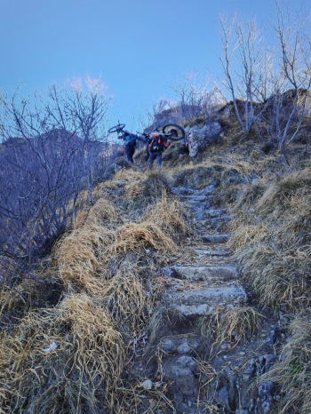
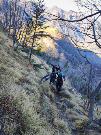
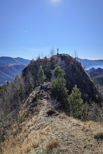
At Frerola we follow for Pradai and find ourselves in a very challenging climb (15% with gravel bottom, white so reflecting the sun), after 150 meters we deviate following the Pizzo Rabbioso trail markers in a path initially rideable only in Emtb, then almost all also in Mtb, about 30/50 meters from the summit we have to push.
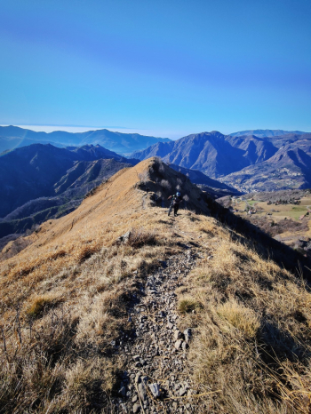
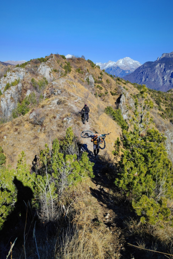
From the summit of Pizzo Rabbioso we admire the beautiful ridge that we will have to ride to reach the other cross, in 5 minutes we ride beautiful the ridge, an exposed S5 trail to be done practically all by pushing.
For those who do not like exposed I recommend this trail.
From the second cross of Pizzo Rabbioso a beautiful S4/S3 descent begins.
Notes: coming down from Rabbioso, wanting to shorten the tour it is possible to descend from the beautiful Valcumina (this trail)
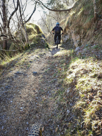
We pass near Cima Camozzera and jump on a beautiful trail that descends to Bracca in the woods with lots of technical switchbacks, we ford the river and the trail becomes a nice rocky S3 very exposed on the left (watch out!), at the next fork we raise the bar and the trail becomes a nice S4 seemingly on nice rock with lots of grip. It climbs up from on a steep road and then takes an eat-and-drink traverse that is not very rideable and then continues on the beautiful technical S2/S3 trail that comes out at Sottoripa and becomes an S3 before finally coming out on the bike path downstream.
Personal considerations: I found the descent from Pizzo Rabbioso very beautiful, I was not too thrilled with the one from Monte Gioco, the traverse connecting Lepreno with Frerola was beautiful, the ascent from Frerola I do not recommend as a first ascent because of the commitment. Avoid doing it in full sun.
Trail style: AM
Personal rating: 7/10
MTB: yes
EMTB: yes (if you can shoulder it)
Duration about 6.5h (by mtb)
Portage: yes
Difficulty climb: easy first part, then very challenging second part
Difficulty descent: average S3/S4 with various S1/S2 links
Drainage: ND
